

An interactive map of London integrates photorealistic models, sensor readings, transport updates and social media.
Online resource shows 30 years of coastal change
By jnally on 15 April, 2021Geoscience Australia’s coastlines tool combines satellite imagery and tidal models to give 10m accuracy.
New podcast features GIS industry leaders
By jnally on 14 April, 2021Episode one of Directions with Stan Grant features GIS exponent and former Governor of Maryland, Martin O’Malley.
EOA earth observation forum goes online
By jnally on 13 April, 2021The 2021 Advancing Earth Observation Forum will be held online in August, followed by a series of webinars.
Australia should become a leader in HD maps
By jnally on 12 April, 2021QUT expert says government and industry must cooperate on HD mapping to enable the success of autonomous vehicles.
Trial of in-orbit processing of satellite imagery
By jnally on 12 April, 2021Computers developed by Australian firm Spiral Blue will be tested aboard Polish STORK satellites later this year.
The FME World Fair is coming to a screen near you
By Spatial Source on 12 April, 20211Spatial, the global geospatial software and solutions company, is pleased to announce that it will be co-hosting four sessions at this year’s FME World Fair on the 7th, 11th, 12th and 13th May. We invite you to register for the FME World Fair now. Although the essence of the World Tour is at the heart of the World Fair, this event is nothing like you’ve seen […]
Machine learning rebuilds cities in 4D
By jnally on 9 April, 2021Scientists have proposed a method for deriving 4D building models using historical maps and machine learning.
Positioning Australia seeks industry input
By jnally on 8 April, 2021The agency wants to hear from users of precise positioning services to help it develop standards and protocols.
$120,000 space prize up for grabs
By jnally on 7 April, 2021Japan’s S-Booster commercialisation contest is open to individuals and teams from the Asia-Oceanic region.
Latest Geospatial News
View all
The Feb/Mar issue of Position is out now, with all the latest news in surveying, spatial and space.
 2022-03-04
ADVERTISEMENT

The Space Manufacturing Hub will drive collaboration between local firms to build satellites and rockets.
2022-03-03 
An environmental group from Fiji and a New Zealand high school are the winners of the Space for Planet Earth Challenge.
2022-03-03 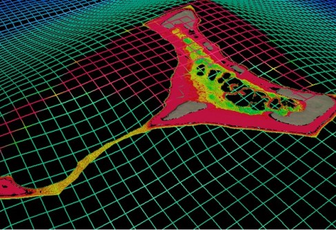
Scientists from NIWA and LINZ have used satellites to chart the Cook Islands’ seafloor in never-before-seen detail.
2022-03-03 
SSSI has organised three events to acknowledge the contributions female professionals make to the industry.
2022-03-02 
Grants are available to help students, young professionals and early career researchers attend Locate22.
2022-03-01
ADVERTISEMENT

ConnectEO aims to build increased collaboration between the European and Australian EO industries.
2022-03-01 
- Sponsored Content
Aidedo was founded based on the practical experience of CEO Aiden Tong while studying and working with many Civil Engineering and Land Surveying firms in developed countries.
2026-06-02
The Board is responsible for place naming within New Zealand, its territorial waters and Antarctica.
2022-02-28 



Events
View All-
Nov 9
2026 Advancing Earth Observation Forum
 Hobart, Tasmania
-
Nov 10
SouthPAN Industry Day
Online -
Nov 13
South West and Great Southern Surveyors Conference
Mantra Bunbury Lighthouse, Bunbury, WA -
Nov 24
Locate26 Conference / 10th Digital Earth Summit
Melbourne Convention & Exhibition Centre -
Nov 30

