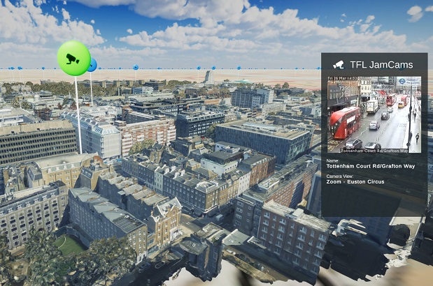
A view of London streets overlaid with traffic information and other data. Courtesy Bluesky.
A new interactive map of London integrates photorealistic 3D models, sensor readings, transport updates and social media data such as geolocated tweets to give a ‘live’ view of the city.
Produced by the Bartlett Centre for Advanced Spatial Analysis (CASA), the platform has been developed with the aim of supporting the environmental monitoring, transport, architecture and urban planning sectors.
The virtual map overlays the various data streams on photorealistic 3D mesh models supplied by Bluesky.
Bluesky’s MetroVista models are generated using a LiDAR hybrid airborne sensor to simultaneously capture vertical and oblique photography along with laser scanned height measurements.
“The value of Bluesky’s MetroVista data is that it provides an immediately recognisable visual reference and context for other, potentially more abstract forms of data,” said Oliver Dawkins, Research Assistant at CASA.
CASA used SafeSoftware FME to pre-process the MetroVista data and merge it with other information such as map tiles, building footprints and point cloud data.
Stay up to date by getting stories like this delivered to your inbox.
Sign up to receive our free weekly Spatial Source newsletter.


