



• May
  • Jun
  • Jul
  • Aug
  • Sep
  • Oct
  • Nov
  • Dec
  • Jan
  • Feb
  • Mar
  • Apr

May

  • 21
  • 1Spatial World Tour 2026 featuring FME – 18 May to 4 June

    Australian capital cities, 18 May to 4 June
    Registrations are open for the 1Spatial World Tour 2026 featuring FME. The global event series returns for 2026 under the theme of ‘Got You Covered,’ bringing together geospatial professionals, innovators, and industry leaders for a day of insights and connection. This year’s 1Spatial World Tour will explore how users can achieve complete confidence in their geospatial ecosystem, from data quality and compliance to automation, integration and emerging technologies. The event will feature expert presentations, live demonstrations of FME 2026’s newest capabilities, customer success stories and real-world applications, deep dive sessions, Q&A sessions with the 1Spatial technical team, and networking opportunities with peers and product specialists. There’ll also be giveaways, swag, training vouchers, and a chance to win tickets to LOCATE26 and The Peak of Data & AI 2027 in London! A major focus of the 2026 tour will be showcasing the latest improvements already released in FME 2026.1, along with a look at what’s coming next under Safe Software’s new quarterly release model. Recent updates include expanded format support, such as for Microsoft Fabric Data Warehouse, PMTiles, HDF5 Raster, Esri File Geodatabase (OpenFile Geodb), and the technology preview of CityGML 3 — enhancements that strengthen enterprise integration, cloud workflows and 3D capabilities. Members of the geospatial community, from first-time users to FME gurus, are invited to present a project, workflow or creative use of FME. Abstract submissions can be made here.
  • 15 day event
    9:00 am - 17:00 pm

June

  • 3
  • Tasmanian State of GIS Conference 2026

    Hobart, Tasmania
    The Tasmanian State of GIS Conference 2026 will be held in Hobart on 3 June. The Conference will bring together Tasmania’s geospatial community of practitioners, researchers, technologists and decision-makers to share ideas, showcase innovations, and chart the future of spatial thinking. The theme for this year’s conference is ‘Island to Insight: AI, Analytics and the Digital Landscape,’ reflecting the ongoing convergence of the geospatial sector and the IT world. Tasmanian geospatial endeavours cover a wide range of activities in sectors such as precision agriculture, forestry management, coastal monitoring, polar science and major infrastructure delivery. Presentations will cover current and future advanced analytics and AI workflows and how they challenge, compliment or enhance traditional GIS and Earth observation practices. Image credit: ©iStock.com/FrankRamspott
  • 1 day event
    12:00 pm - 22:00 pm
  • 4
  • Webinar: What's next for Pozi, meet the team

    Online webinar
    The ‘What's next for Pozi: Meet the team leading the way’ webinar will bring current and potential users up to date with Pozi’s new team and its vision for what's next. The webinar will outline the Pozi product roadmap and where its heading and will include a ‘guided tour’ of Site Manager, a new self-service admin tool that enables GIS administrators to manage users, build custom maps, and configure data sources from one place. The presenters will be Matt Robinson, Technical Director with Chartis Technology; Chris Scott, General Manager Innovation, Technology & Development with MNG Survey; Andrew Jeffrey, Spatial Technology Consultant with Chartis Technology; and Dave Bullen, Business Development Manager with MNG Survey.
  • 1 day event
    11:00 am - 12:00 pm

July

  • 4
  • XXV ISPRS Congress 2026

    Metro Toronto Convention Centre, Toronto, Canada
    The International Society for Photogrammetry and Remote Sensing’s (ISPRS) XXV Congress will be held in Toronto, Canada, from 4 to 11 July 2026. This will be the first ISPRS Congress to held in Canada since the event in Ottawa in 1972, so it will be an historic occasion. The event will bring together researchers, practitioners and industry leaders from around the globe to explore the latest advancements, trends and applications in photogrammetry and remote sensing. The theme of the Congress, From Imagery to Understanding, captures the role of ISPRS and its scientific activities, and will culminate in a legacy project to create materials that can be used by the ISPRS community to better promote to funding agencies and others the important role that it plays in the world’s economic and environmental activities. The Congress will run in parallel with the 47th Canadian Symposium on Remote Sensing (CSRS). The abstract submission deadline has been extended to 17 November 2025, and early bird registration is now available.
  • 8 day event
    23:00 pm - 7:00 am
  • 26
  • 12D Tech Forum

    Brisbane Convention & Exhibition Centre
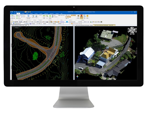
    Experience the next wave of AEC innovation at the 12d Tech Forum at the Brisbane Convention & Exhibition Centre. This is where industry leaders, software experts, and forward-thinking civil and water engineers, surveyors and information managers come together to explore the tools and technologies transforming civil and water design, surveying, and infrastructure delivery. From cutting-edge 12d Model and 12d Synergy advancements to powerful workflows in digital engineering and BIM, the 12d Tech Forum is packed with insights you can apply immediately. Expect high-impact keynotes, live demos and real-world case studies — all designed to sharpen your skills and push project performance further. More than an event, it’s a hub for connection, collaboration and the ideas shaping tomorrow’s built environment.
  • 3 day event
    9:00 am - 17:00 pm

August

  • 5
  • Putting the ‘Geo’ into Geospatial

    Online webinar
    The Geoscience Australia Distinguished Lecture, “Putting the ‘Geo’ into Geospatial: Shaping the future of Positioning Australia,” will cover future direction of the program, reflecting on its past achievements and how it will meet future positioning demands. As it moves beyond the establishment phase, the Positioning Australia program will strengthen its capability for continued future relevance. The program builds on opportunities arising from Australia’s geographic location, its technological capabilities, strong partnerships and internationally significant positioning infrastructure. The adoption of PNT-based technologies is changing requirements for the systems delivering it. There is increasing awareness that society’s increasing reliance on modern technologies brings potential risks from vulnerabilities in PNT systems. This lecture will highlight how Positioning Australia will address these issues, including an often invisible risk: the reliance of PNT systems on a global geodesy supply chain that is increasing vulnerable. Presented by Dr Martine Woolf, (Branch Head Positioning Australia), Ryan Ruddick (Director GNSS Informatics and infrastructure), Dr Anna Riddell (Director GNSS Analysis), Dr Lisa Hall (Director National Geodesy) and Phil Shears (Director PMO), the lecture will outline how Geoscience Australia aims to continue maximising return on Commonwealth investment in reliable positioning, modernising infrastructure, enhancing access and efficiency, and supporting national resilience and economic growth. Image credit: ©stock.adobe.com/au/Inna
  • 1 day event
    11:00 am - 12:00 pm
  • 7
  • Spatial Information Day 2026

    Adelaide Convention Centre
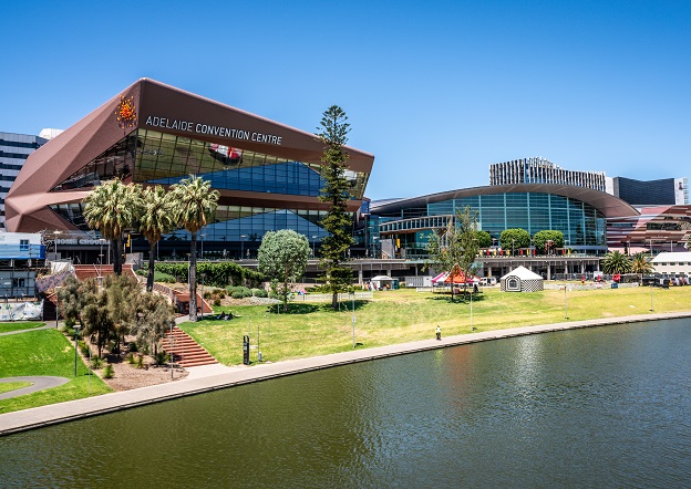
    South Australia’s Spatial Information Day (SID) will be held on Friday, 7 August at the Adelaide Convention Centre. An annual highlight of the South Australian geospatial community’s calendar, SID brings together experts from the fields of surveying, GIS, remote sensing, photogrammetry and more, for wide-ranging discussions and networking. The theme for 2026 is ‘Every future starts somewhere: From ground truth to space, shaping what comes next,’ and for 2026 the organisers are hoping to attract around 400 delegates and 40 speakers. This year will also see the introduction of the inaugural South Australian EISSI Awards Dinner. The call for abstracts and papers is now open, with speakers invited to submit their ideas within a wide span of topics, such as:
    • Various spatial disciplines, e.g. GIS, surveying and so on;
    • Real-world case studies;
    • Insights into innovation techniques and approaches;
    • Smart cities and infrastructure;
    • Emerging technologies.
    A sponsorship prospectus is now available, while tickets for the event are expected to go on sale soon.  
  • 1 day event
    9:30 am - 17:30 pm
  • 26
  • GeoCart'2026: 12th National Cartographic Conference

    Victoria University of Wellington, New Zealand
    GeoCart'2026, Aotearoa New Zealand's 12th National Cartographic Conference, will convene from 26 to 28 August at the Te Aro campus of Victoria University of Wellington. The event aims to bring together a wide cross-section of professionals, researchers, and enthusiasts engaged in cartography, map curatorship and research, geovisualisation, and GIS. Participants at GeoCart'2026 will hear about the latest developments and research, learn about current and upcoming projects and products, network with their counterparts in the greater community, and develop a deeper understanding of cartography and mapping. The deadline for abstract submissions is 15 May 2026. In addition to the main conference, there will also be a pre-conference Map Design Workshop that will explore techniques for terrain visualisation, feature symbology and layout composition. Plus, entries are invited for the NZ National Map Exhibition 2026, all of which will be put on display and judged during the conference. Subject to the number and quality of entries received, a winner will be announced for each of two categories: Printed Map Product and Digital Map Product. All entries from New Zealand domiciled cartographers will be eligible for selection to represent New Zealand at the 2027 ICA International Cartographic Exhibition in Vancouver, Canada.
  • 3 day event
    7:00 am - 15:00 pm

September

  • 2
  • Commercial UAV Expo

    Las Vegas
    The Commercial UAV Expo in Las Vegas is considered one of the premier events for the commercial drone industry, focusing on the integration/operation of commercial sUAS. The 2026 Expo will feature exhibits and demonstrations by UAV solutions providers, plus keynotes and panel discussions. The show covers all vertical industries, plus it hosts numerous co-located events. The organisers are expecting 3,500-plus attendees, 225-plus exhibitors, 150-plus speakers and attendance by ‘drone royalty’ from six continents. Use the code SAVE100 for a US$100 discount on any registration option.
  • 3 day event
    2:00 am - 10:00 am
  • 9
  • Survey and Spatial New Zealand Conference 2026

    Cordis Hotel, Auckland
    The Survey and Spatial New Zealand Conference 2026 aims to connect the surveying and spatial community to explore innovation, technology and the future of the profession. The event will attract professionals from across land development, urban design, resource management, civil engineering, surveying (cadastral, hydrographic and engineering), positioning and measurement, and spatial/GIS for two days of insights. Registrations are due to open in April 2026. Image credit: ©stock.adobe.com/au/StudioProX
  • 3 day event
    7:00 am - 15:00 pm
  • 9
  • BIM World COPENHAGEN 2026

    Copenhagen, Denmark
    BIM World COPENHAGEN will be held in Copenhagen, Denmark, from 16 to 17 September 2026, bringing together a wide range of experts from across the fields of digitalisation in construction, real estate and urban development. This includes surveyors, mappers, architects, engineers, contractors, building owners and consultants. Billing itself as ‘Fuelling the future of the building industry with data and digitalization’, the event will tackle the transformation facing the construction industry, including the pressure to reduce emissions, cut waste and design for circularity, by zooming in on data as the essential link between the green and digital transitions.
  • 1 day event
    16:30 pm - 1:00 am
  • 18
  • Women Surveyors Summit

    San Diego
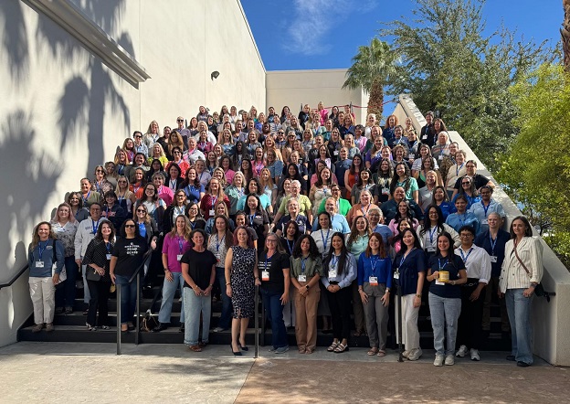
    The 7th Women Surveyors Summit will be held at the Westgate Hotel in San Diego from 17 to 20 September 2026. The in-person ‘for women, by women’ event will include presentations on land surveying, CAD, GIS, surveying of native lands, AI, mentoring, drones and more. There will also be opportunities for continuing education. To get a taste for what the Summit is like, read our article about the 2025 event: Reflections from the Women Surveyors Summit.
  • 3 day event
    1:00 am - 10:00 am

October

  • 8
  • Colloquium on Scientific and Fundamental Aspects of GNSS

    Montreal, Canada
    The 10th International Colloquium on Scientific and Fundamental Aspects of GNSS will bring together members of the European scientific community and international partners involved in the use of Galileo and other GNSS in their research. The colloquium will address several major areas of research:
    • Scientific applications in meteorology, geodesy, geodynamics, geophysics, space physics, oceanography, land surface and ecosystem studies;
    • Scientific developments in physics with a potential impact on future GNSS, particularly in testing fundamental laws of physics;
    • Aspects of metrology such as reference frames, on board and ground clocks, precise orbit determination and time and frequency transfer; and
    • Scientific aspects of satellite navigation, positioning and its applications, such as signal propagation, precise positioning;
    The conference will be organised as a series of plenary talks, parallel half day sessions and poster presentations.
  • 3 day event

November

  • 9
  • 2026 Advancing Earth Observation Forum

    Hobart, Tasmania
    The 2026 Advancing Earth Observation Forum aims to bring together professionals from across Australia and beyond, to share, learn, connect and collaborate. The four-day event promises to attract a diverse range of participants from the Earth observation community, including those in industry, government, research, defence, not-for-profits and educational institutions. The 2026 Forum will build on the momentum generated at the 2024 event in Adelaide and the inaugural AEO Forum held in Brisbane in 2022.
  • 4 day event
    9:00 am - 17:00 pm
  • 24
  • LOCATE26 / 10th Digital Earth Summit

    Melbourne Convention & Exhibition Centre
    LOCATE is Australia and New Zealand’s flagship geospatial event, where the region’s smartest minds meet to explore the technologies, ideas and innovations shaping our world. Each year, leaders from government, industry, research, and emerging sectors come together to uncover the latest breakthroughs and real-world applications transforming infrastructure, environment, agriculture, energy, mining, emergency response, and urban planning. If you want to stay ahead of spatial trends, connect with decision-makers, and be part of the conversations driving smarter, data-led futures, this is the place to be. LOCATE26 will be held at the Melbourne Convention and Exhibition Centre from 24 to 26 November. Organisers expect at least 1,000 people to attend, making it a not-to-be-missed opportunity for speakers to share their news and views, and for companies and organisations to promote their products and solutions to a prime audience. Co-located with LOCATE26 will be the 2026 Digital Earth Summit, a major annual global conference of the International Society for Digital Earth (ISDE). The ISDE has brought together global experts for more than two decades, delivering world-leading summits and symposia across 15 countries. In 2026, the combination of the Summit and LOCATE26 will bring a unique international gathering of scientists, industry innovators, educators and government leaders to Australia.
  • 3 day event
    8:30 am - 17:00 pm
  • 30
  • 2026 Pacific Islands GIS & Remote Sensing User Conference

    Suva, Fiji
    With a theme of ‘Strengthening and Expanding Geospatial Networks in the Pacific Islands,’ the 2026 Pacific Islands GIS & RS User Conference aims to build and enhance geospatial networks in the Pacific Islands by being a forum where experts, practitioners and policymakers can explore cutting-edge geospatial technologies and collaborations. The conference is the largest GIS and remote sensing conference attended by Pacific Islanders, attracting more than 300 attendees every year. The event will offer a unique platform to share knowledge, strengthen regional partnerships, and drive innovation in mapping, remote sensing and spatial data infrastructure.
  • 1 day event
    7:30 am - 16:00 pm

February

  • 5
  • 2026 National EISSI Awards

    Melbourne Convention & Exhibition Centre
    The national Excellence in Surveying and Spatial Information (EISSI) awards will be presented at a gala occasion on 5 February 2027 in Canberra. The EISSI awards represent the highest level of professional recognition within the Australian surveying profession. The event will bring together all 2026 state EISSI category winners to compete for national honours, including national category awards and the overall national award. The award categories are:
    • Infrastructure and construction
    • Extra dimension and innovation
    • Community & sustainable environment
    • Rural cadastral surveying & land titling
    • Urban cadastral surveying & land titling
    • Surveying project management
    • Mine surveying
    • Professional surveyor of the year
    • Young professional surveyor of the year
    • Professional organisation of the year (large)
    • Professional organisation of the year (small)
    • University project of the year
    • Vocational student of the year
  • 1 day event
    18:30 pm - 22:30 pm
To have your event listed on Spatial Source, please email full details to jnally@intermedia.com.au.

Newsletter

Sign up now to stay up to date about all the news from Spatial Source. You will get a newsletter every week with the latest news.