

Southern Launch and ATSpace aim to launch back-to-back Kestrel I missions by the end of the December.
New Geospatial Council holds its first meeting
By jnally on 12 December, 2022The Geospatial Council of Australia has held its inaugural Board Meeting, ratifying Peter Woodgate as President.
FrontierSI signs agreement for Ginan enhancement
By jnally on 2 December, 2022The deal with GA, Curtin University and the University of Newcastle will support LEO satellites.
FARO acquires LiDAR scanning provider, SiteScape
By jnally on 2 December, 2022SiteScape enables LiDAR-equipped mobile devices to capture indoor spaces, especially in the AEC market.
Kleos teams up with UP42 for geolocation
By jnally on 1 December, 2022The new partnership will see Kleos’ RF geolocation data offered to UP42’s geospatial users.
Advancing GNSS, Geoscience and Water Infrastructure
By SS Advertiser on 1 December, 2022The use of high-accuracy GNSS technology is now a central focus among water and wastewater service providers to enhance their overall operations and profitability.
Latest Geospatial News
View all
The awards were presented for work involving waterways, bridges, bushfire warning systems and more.
 2023-09-04
ADVERTISEMENT
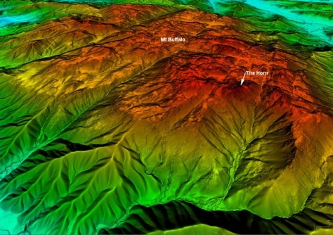
Aerial LiDAR has been used to generate a 1-metre DEM of parts of Victoria’s Alpine and Mt Buffalo National Parks.
2023-09-04 
Low Earth orbit satellite observations are accelerating society’s journey towards sustainability.
2023-09-01 
Geospatial is more than an industry — it is a phenomenon that can change the world, says Woolpert’s Joe Seppi.
2023-08-31 
The Royal Australian Navy has trialled a LiDAR-equipped camcopter for mapping seabed and beach areas.
2023-08-30 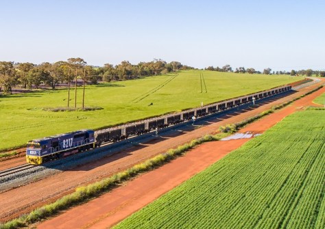
Nearly 233,000 hectares covering 7,699 parcels have been updated to ensure the Inland Rail route’s accuracy.
2023-08-30
ADVERTISEMENT

The 2023 NSW Geospatial Excellence Awards winners were presented with their awards in Sydney on 24 August.
2023-08-29 
- Sponsored Content
Aidedo was founded based on the practical experience of CEO Aiden Tong while studying and working with many Civil Engineering and Land Surveying firms in developed countries.
2026-06-02
Tasmanian engineering firm Gandy and Roberts is winning over clients using the NavVis VLX mobile mapping system.
2023-08-28 



Events
View All-
Nov 9
2026 Advancing Earth Observation Forum
 Hobart, Tasmania
-
Nov 10
SouthPAN Industry Day
Online -
Nov 13
South West and Great Southern Surveyors Conference
Mantra Bunbury Lighthouse, Bunbury, WA -
Nov 24
Locate26 Conference / 10th Digital Earth Summit
Melbourne Convention & Exhibition Centre -
Nov 30

