Global Navigation Satellite Systems (GNSS) and Geographic Information System (GIS) are providing significant improvements to the field validation and logical correction of networked asset data using business rules for the utility sector to improve asset management, maintenance productivity and reliability for data analysis.
The use of high-accuracy GNSS technology is now a central focus among water and wastewater service providers to enhance their overall operations and profitability by creating digital twins with accurate spatial data. Geospatial data corrections in the field are why many water utilities in Europe and USA are (1) saving time, (2) cutting operational expenses, and (3) definitively improving the accuracy of their asset management systems by capturing mapping (sub metre) or survey-grade locations.
Applications of Eos-GNSS using the recently released Geoscience Australia SBAS called SouthPAN in the water sector provides an out of the box, and ESRI Field Maps compatible solution.
- GNSS system is ideal to aid the survey and mapping of gravity water supply schemes.
- Maintenance of supply networks is also enhanced as all the system components can be easily relocated on the ground using this technology
- GNSS data can be analysed to find out the density or coverage of a given area in terms of water supply.
- With spatially accurate data, scheduled maintenance visits can be applied to each water source and supporting infrastructure to ascertain its condition and easy to relocate them in the field.
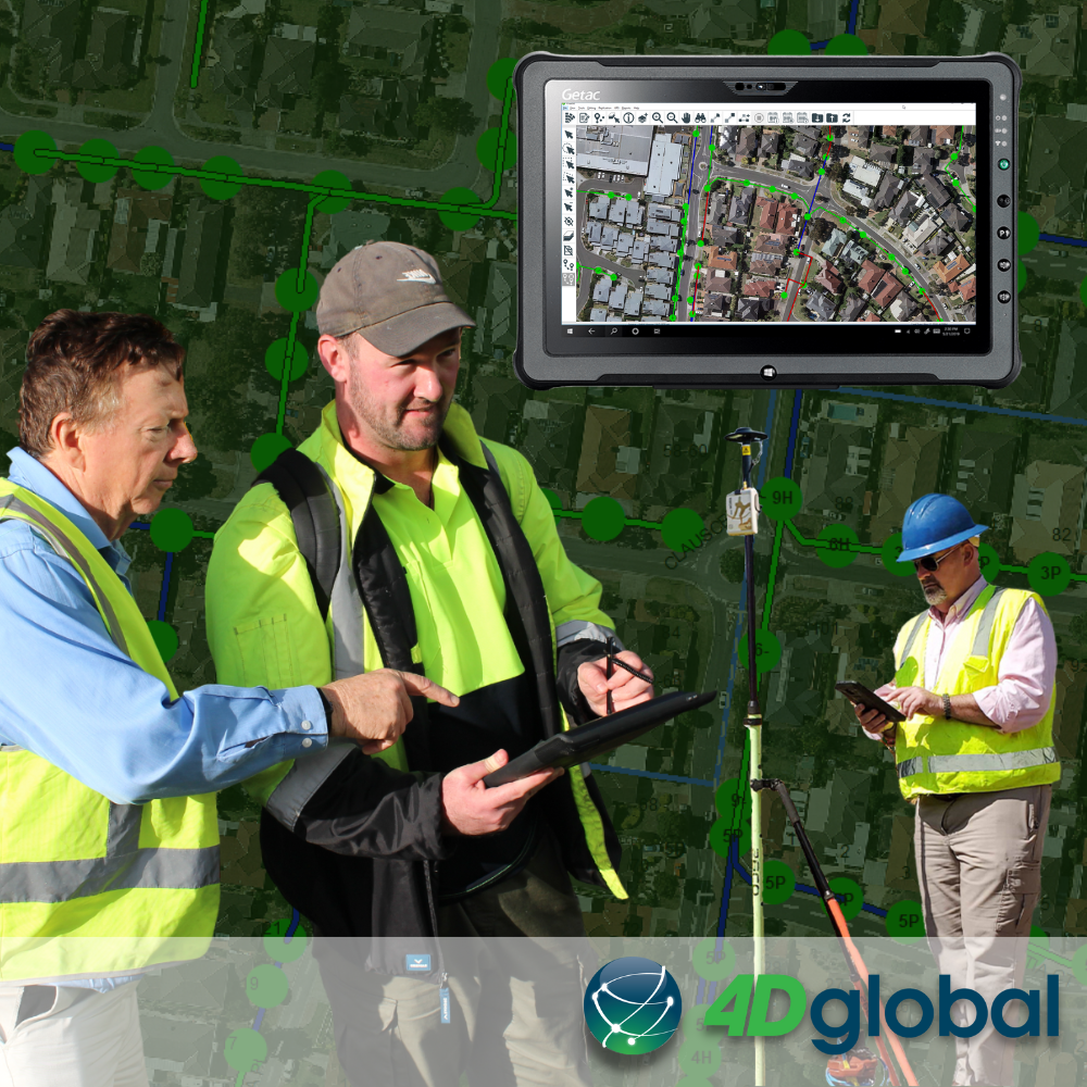
- Field Data can be quickly shared with your GIS for spatial analysis and smart presentations.
- Located and mapped Sub Surface assets can be easily found to minimise time and earth works.
All infrastructure owners can greatly benefit by using GPS satellite positioning as operated by the USA Department of Defense, and other complementary satellite constellations available for use in Eos-GNSS to provide even greater accuracy, such as:
- Russia Glonass
- European Union Galileo
- China BeiDou
Quality GNSS receivers, are designed to simultaneously monitor all 4 of these constellations with 1 or more of the regional satellite systems available in Australia and New Zealand being:
- Japan QZSS
- India IRNSS
The simultaneous use all these systems at one to vastly improve performance and accuracy. When 2 or more systems are used by a receiver it is known as GNSS.
Be inspired! Please click below to read more about the real-life benefits of Eos-GNSS receivers as used in Water Utility Districts
5 Water Utilities Using Bluetooth GNSS Receivers – Eos (eos-gnss.com)
Peter Terrett is a GNSS Specialist with more than 36 years hands on experience across all industries.
Contact us to help you map and manage your world – 4D Global
pterrett@4dglobal.com.au (03) 9466 5255 www.4dglobal.com.au