

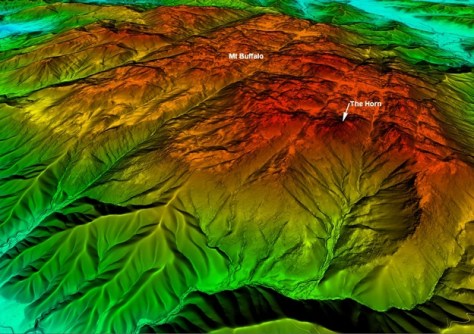
Aerial LiDAR technology has been used to capture data to generate a 1-metre resolution Digital Elevation Model (DEM) of parts of Victoria’s Alpine and Mt Buffalo National Parks, including Mt Buffalo, Mt Feathertop and the Razorback.
The LiDAR data was acquired by the Coordinated Imagery Program within Vicmap Spatial Services on behalf of Parks Victoria, and will be used to optimise the design of hiking trails.
The data will show where water will flow over the terrain surface during high rainfall periods and thereby help to identify areas that are likely to flood or hold water.
The DEM data will assist in identification of areas that need drainage controls to mitigate erosion, as well as supporting emergency planning and management.
Having such highly accurate data means that the number of field trips can be reduced, thereby improving worker safety and reducing disruption to the sensitive environment.
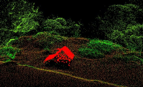
As well as the overall terrain, the LiDAR scans also captured some iconic huts, such as the oldest surviving hut in the Victorian Alps, Wallace Hut, built in 1889.
The new data will be added to the Vicmap LiDAR Point Cloud and Vicmap DEM Collections — both of which can be accessed through the Coordinated Imagery Program — as well as being incorporated into the forthcoming Vicmap 1m DEM, planned for release in late 2023.


