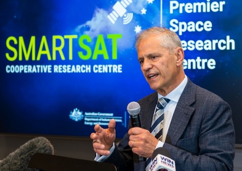
The OzFuel bushfire mitigation satellite instrument is one of the projects to benefit from the new investment.

Glenn Cockerton steps down as Spatial Vision CEO
Industry veteran Cockerton will remain on Board, with Cameron Selkrig taking his place as CEO as of 1 May.
Read moreInsights
View All-
 Terrestrial scanning solution from Emlid and PIX4D accelerates data capture for construction and utilities
 -
 Reduce survey costs with HubX by Sphere Drones
 -
 Locate24 Full Program Released | Register now!
 -
 Drones adoption continues to soar: 60 million commercial flights by 2043, saving Australian businesses over $10 billion.
Latest Geospatial News
View all
ADVERTISEMENT
Australia’s economy will be boosted by half a billion dollars by federal investment in precise positioning.
 2023-09-26
A detailed Project Definition Plan will be considered by the state government at its December mid-year review.
 2023-09-25
Lundy served for more than 19 years as a senator for the ACT, followed by a career in corporate leadership.
 2023-09-22
FIG is creating a worldwide inventory of university education in land surveying and geomatics.
 2023-09-20
The 25th annual NSW Excellence in Surveying and Spatial Information Awards were presented on 16 September.
 2023-09-20
ADVERTISEMENT
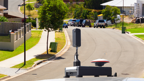
RapidMap now offers the Smart Street 360 which is a rapid deployment panorama camera capture GNSS solution to create personalised Spatially accurate Street Views efficiently. Ideal for Local Government, use for roadside assessments pre and post disaster or simply to record the current condition of shared paths, sealed and unsealed roads.
 2023-11-01
A case study of mangroves, coastal protection and accounting for Australia’s vast ocean ecosystems.
 2023-09-18
 Cool Tools
View All-
 Terrestrial scanning solution from Emlid and PIX4D accelerates data capture for construction and utilities
 -
 Reduce survey costs with HubX by Sphere Drones
 -
 Locate24 Full Program Released | Register now!
 -
 Drones adoption continues to soar: 60 million commercial flights by 2043, saving Australian businesses over $10 billion.
Events
View All-
May 2
GISTAM 2024
 Angers, France
 -
May 7
Locate24
 International Convention Centre, Sydney
 -
May 7
New Zealand: Digital Twin 2024 Summit
 Mövenpick Hotel Auckland, New Zealand
 -
May 9
4th International Symposium on Applied Geoinformatics 2024
 Wroclaw University of Science and Technology, Wroclaw, Poland
 -
May 13
Geospatial World Forum 2024
 Rotterdam, The Netherlands


