

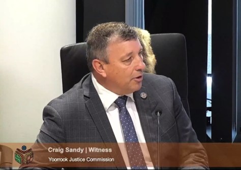
Victoria’s Surveyor-General, Craig Sandy, has issued an historic apology on behalf of the state’s past and present Surveyors-General, for the role that they and the surveyors working under their direction have had in the process of dispossession of land from First Peoples in Victoria.
Sandy made the apology while giving oral evidence at the ongoing hearings of the Yoorrook Justice Commission, which is described as “the first formal truth-telling process into historical and ongoing injustices experienced by First Peoples in Victoria”.
The Yoorrook Justice Commission was established by agreement between the First Peoples’ Assembly of Victoria and the Victorian Government, but operates independently of both. The Commission is aiming to deliver its final report next year.
Appearing on day five of the hearings, Sandy, who has been in his role since August 2017, began by saying that “I accept sovereignty was never ceded by First Peoples.”
He then went on to make his historic apology during his oral evidence (having previously submitted written evidence back in February); the following is a transcript (E&OE) of his statement:
“The Surveyor-General of Victoria is the state’s primary authority on land boundaries and has functions and responsibilities that relate to land surveying, land status and electoral boundaries. I provide an important leadership role to [the] land surveying profession, which has approximately 400 practicing licensed surveyors who perform property surveys for the community. I lead an office known as Surveyor-General Victoria, which provides authoritative land surveying, Crown boundary approvals, Crown plan drafting and geographic place naming services to the government and to the private sector…
“In preparing my statement for the Commission and for my appearance to give oral evidence today, I have reflected on the historical role of the Surveyor-General in this state, its legacy and my current work.
“There have been four Surveyors-General for New South Wales prior to the declaration of Victoria as a colony that operated in the area we know as Victoria prior to 1851. The position of Surveyor-General has historical significance and has played a major role in land settlement and land administration within the state.
“I’ve reflected on the work of my predecessors in title. My written statement to the Commission includes various acknowledgements, and in summary these include:
- I acknowledge that Surveyors-General both past and present, played a role in the dispossession of First Peoples from their land.
- I acknowledge that under the direction of the Governors and governments, the role of Surveyors-General has accepted the premise of Terra Nullius. The survey and legal instruments produced from this work were one of the important steps which ultimately resulted in the dispossession and removal of First Peoples from their lands in this state. The land systems established in New South Wales initially and subsequently in Victoria, did not recognise the occupation and possession of First Peoples.
- I accept and deeply regret that the presence on Country of Surveyors-General, or surveyors under direction, has caused First Peoples’ community significant trauma and diminished their ability to care for Country, practice culture and exercise their rights.
- I acknowledge that this contributed significantly to a loss of culture and language and impacted the physical, spiritual and economic well-being of First People.
“In addition to these and other acknowledgements in my written statement, I have continued to reflect on the historical events, laws and practices that led to the dispossession of First People from their lands through the settlement and alienation of what is presently referred to as Crown land.
“I have also watched, listened and read parts of the evidence given to the Commission, including the lived experience evidence from First Peoples in this hearing block. I recognise and respect the strength and resilience of First Peoples in talking about their lived experiences of injustices, including injustices with respect to land. The evidence of my work to prepare to be a witness to this Commission has reinforced my understanding of the dispossession and removal of First Peoples from their land and the seriously adverse impacts this has had and continues to have on the physical, spiritual and economic well-being of First Peoples in this state.
“With all this in mind, as the current Surveyor-General of Victoria, I take this opportunity to formally and sincerely apologise for the role that Surveyors-General, past and present, and surveyors working under our direction, have had in the process of dispossession of land from First Peoples of the area now known as Victoria.
“In making this apology, I accept the actions performed by Surveyors-General did not understand the First Peoples’ complex land systems that were in fact already in place. I also understand that Surveyors-General and surveyors employed by them were possibly the first Europeans seen by First Peoples. The work of these early surveyors began a cycle resulting in the removal of First Peoples from their lands. The impacts of that dispossession are still being felt by the First Peoples today in many profound ways, as I have acknowledged in my opening statement. The work of surveyors has been a part of a broader systemic process that enabled land injustice to occur and continue to occur.
“As the current Surveyor-General of Victoria, that is why I have taken the step I have today to publicly and genuinely apologise for the role of surveyors in the process of land dispossession of First People in Victoria.”
Since making his statement of apology, Sandy has received wide support and acclaim from many individuals in the geospatial sector, as evidenced by comments posted on LinkedIn.
Sandy’s oral evidence to the Commission is available for viewing online.


