

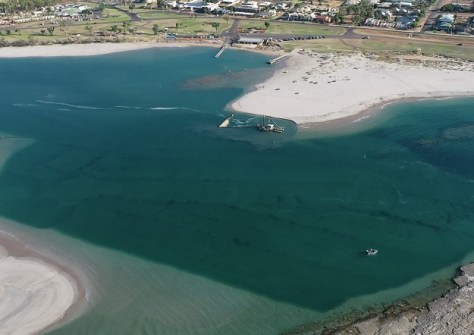
Biennial maintenance dredging has begun at the mouth of the Murchison River in Kalbarri, Western Australia, after hydrographic surveying revealed that the channel width had more than halved in the past year.
WA Department of Transport (DoT) A/Manager Asset Management, Sam Mettam, said the survey had shown that the channel had narrowed by about 60 metres in the past 12 months, down from 100 metres to around 40 metres.
“A $1.6 million dredging campaign during the next four months will see about 45,000 cubic metres of material removed to reinstate the original 140 metre channel width to ensure safe navigation until the next campaign, due in 2026,” Mr Mettam said.
Two years ago, the DoT fast-tracked the dredging campaign and extracted a record 95,000 cubic metres of material after a severe winter combined with the impacts of Cyclone Seroja resulted in concerning levels of infilling, making navigation dangerous.
“At DoT we are constantly working to make waterways safer and this project will deliver a wider passage for both commercial and recreational skippers through what are known to be treacherous waters in poor conditions,” Mr Mettam said.
The dredged material will be pumped approximately one kilometre north of the river mouth.


