

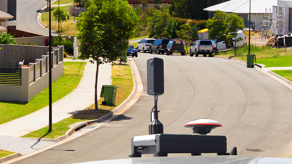
RapidMap now offers the Smart Street 360 which is a rapid deployment panorama camera capture GNSS solution to create personalised Spatially accurate Street Views efficiently. Ideal for Local Government, use for roadside assessments pre and post disaster or simply to record the current condition of shared paths, sealed and unsealed roads.
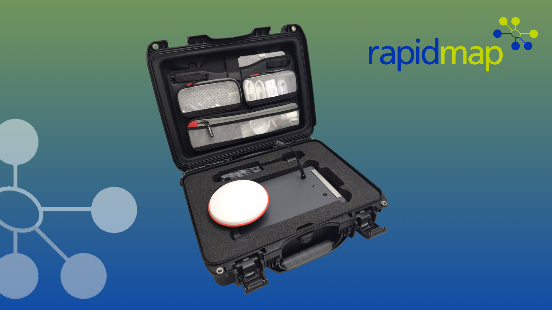
RapidMap’s core mission revolves around the digitalization of asset infrastructure for life cycle management, paving the way for sustainability and enhanced efficiency. We collect quality data once for Local Government Public Works engineers and Maintenance Contractors can use this intelligence in many ways. Now you could buy your own 360 Mobile Mapping solution for regular data collection events.
RapidMap’s innovative road network intelligence platform empowers asset engineers to verify condition of infrastructure and the status of the environment while, revolutionizing road inspections to increase safety and significantly reducing costs.
Ideal for Dilapidation Surveys and current state assessments of pathways and road corridors which can be conducted later and safely at the Desktop. We create personalised Google Street Views for many purposes including urban forests and environmental assessments of the roadside vegetation.
Enabled by advanced navigation 360 mobile mapping technologies, RapidMap offers our customers an uninterrupted view of the entire physical road network or street corridors for their GIS platforms, providing comprehensive insights for predictive road maintenance, asset management plans, traffic surveillance, safety audits, to move towards autonomous transportation.
Seamless Scalability with Spatial Accuracy
The Road 360 Mobile Mapping solutions used by RapidMap is designed with scalability at its core. This adaptability allows for the seamless coverage of local road networks, bustling urban landscapes, and even entire states or nations. The ultimate goal? To capture real-world conditions and enable financially responsible and sustainable survey update intervals.
Pre & Post Bushfire or Natural Disasters, this method of capture is quickly becoming the best way to provide evidence about the conditions of the roadway or environment before and after a major event to support the requests for funding to repair road assets, bridges and utility infrastructure after an event.
All Roads lead to RapidMap
If you are looking for an affordable, scalable 360 camera technology for Road side GIS ready assessments and to provide you Pre or Post Disaster imagery as spatial panorama evidence along your shared paths, sealed and unsealed roads or bike trails, contact us on +613 9466 5200 or email info@rapidmap.com.

Comments are closed.