

The Young Professionals Mentoring Program returns this year to help develop the next generation of experts.
Copernicus Masters 2021 competition launched
By jnally on 5 May, 2021More than $1.3m is up for grabs in this international competition based on use of data from the Copernicus program.
Multi-feed antenna system to boost satcoms
By jnally on 5 May, 2021Technology developed for CSIRO’s ASKAP radio telescope will enable concurrent comms with hundreds of satellites.
SSSI forms Digital Twin working groups
By jnally on 4 May, 2021Surveying and spatial science industry members are invited to join SSSI’s new spatial digital twin working groups.
ACCELERATE PROCESSING OF LARGE MAPPING PROJECTS
By Spatial Source on 3 May, 2021Handling large mapping projects, meeting deadlines and delivering high-quality results are typical challenges in photogrammetry. This is particularly true during peak where multiple projects, often comprising tens of thousands of images, need to be processed in a timely manner. Mapping firms can greatly benefit from better control of project schedules, a reduction in processing times […]
New 35m dish for ESA’s New Norcia station
By jnally on 3 May, 2021The $70 million dish will be built in cooperation with the Australian Space Agency and operated by the CSIRO.
Dragonflies could be the future of drones
By jnally on 3 May, 2021Flapping wings based on those of the “ultimate flying machine” could herald a new generation of efficient drones.
First Pleiades Neo satellite placed into orbit
By jnally on 3 May, 2021The Airbus spacecraft will add half a million square kilometres coverage each day at 30cm native resolution.
Feedback sought in GIS industry survey
By jnally on 28 April, 2021Industry members are being asked for their views on the challenges of professionalisation in the GIS sector.
ScanX automates surveyors’ 3D point cloud data
By Spatial Source on 27 April, 2021Software start-up ScanX offers a new cloud-based platform to upload and automate surveyors’ 3D point cloud data using artificial intelligenc
Latest Geospatial News
View all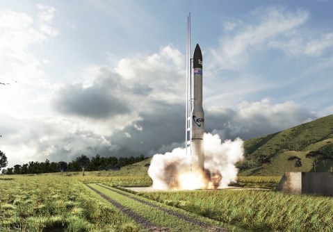
The government funding will help to advance local space manufacturing and launches from Australia.
 2022-03-29
ADVERTISEMENT

Turner leads the Minderoo Foundation’s Fire and Flood Resilience Initiative, and is an expert on AI.
2022-03-29 
AI and ML innovators are needed to help Transport and Main Roads Queensland launch its first Spatial Lab.
2022-03-23 
The partners will explore how passive radar can be integrated with a novel antenna design and smallsat platforms.
2022-03-23 
Work is progressing on the development of a National Standard of Competency for Licensed/Registered Surveyors.
2022-03-22 
Geospatial resources, space development, data use and skills development are on Australia’s research agenda.
2022-03-22
ADVERTISEMENT
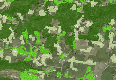
Victoria’s DELWP has used machine learning techniques to refresh the state’s 20-year-old tree cover dataset.
2022-03-22 
- Sponsored Content
Aidedo was founded based on the practical experience of CEO Aiden Tong while studying and working with many Civil Engineering and Land Surveying firms in developed countries.
2026-06-02
‘How Cool is your School?’ will help combat heat stress while also teaching kids about spatial technologies.
2022-03-21 



Events
View All-
Nov 9
2026 Advancing Earth Observation Forum
 Hobart, Tasmania
-
Nov 10
SouthPAN Industry Day
Online -
Nov 13
South West and Great Southern Surveyors Conference
Mantra Bunbury Lighthouse, Bunbury, WA -
Nov 24
Locate26 Conference / 10th Digital Earth Summit
Melbourne Convention & Exhibition Centre -
Nov 30

