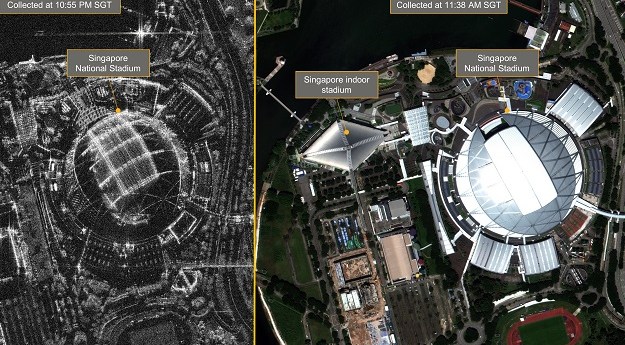
The new platform will provide enhanced capabilities and improved access to NovaSAR-1 data.
synthetic aperture radar
-
SmartSAT CRC, industry and academia are using satellite radar and optical data to...
2025-05-06
iQPS plans to have a constellation of 36 satellites, able to image specific...2025-03-25
The antenna for the NISAR synthetic aperture radar satellite has arrived in India...2024-11-13
ADVERTISEMENTAustralia will benefit from the eased restrictions on electro-optical and radar remote sensing...2024-10-19
The Sentinel-1C synthetic aperture radar satellite is due to replace the failed -1B...2024-10-11
Called ‘Leoflect,’ the project has received $100,000 in financing from a South Australian...2024-09-06
New research aims to improve the inspection of roads, retaining walls and embankments...2024-08-14
Australian NovaSAR-1 users now have access to standardised data that require minimal additional...2024-07-05
CA$6.8 million will go to Canadian companies to help satisfy the nation’s needs...2023-03-17
The testing included noise, vibration, electromagnetic and radio frequency compatibility checks.2023-02-22
Maxar customers will have dedicated access to Umbra SAR data, with resolution down...2023-02-15
Mission operators and engineers have been unable to fix the spacecraft’s electronics power...2022-08-05
New algorithms are key to measuring sea-level change in coastal areas with millimetre-per-year...2021-07-14
Australian researchers can now apply to direct the synthetic aperture radar satellite’s advanced...2021-07-08
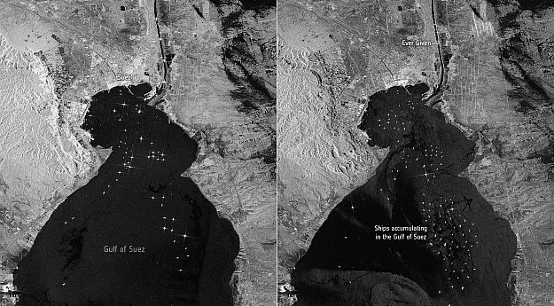
Sentinel-1 images show shipping backing up in the Gulf of Suez after the...2021-03-29
CSIRO will use ten percent of tasking and acquisition time on NovaSAR-1 as...2018-09-17
In an exclusive excerpt from Position 96, we chat with Airbus’ SAR guru,...2018-08-29
Issue #96 of Position magazine re-examines core principles of openness in spatial disciplines...2018-08-22
Agreements will see data-sharing, new products and an Earth imagery system for Thailand.2018-06-27
Newsletter
Sign up now to stay up to date about all the news from Spatial Source. You will get a newsletter every week with the latest news.
© 2025 Spatial Source. All Rights Reserved.
Powered by WordPress. Designed by


