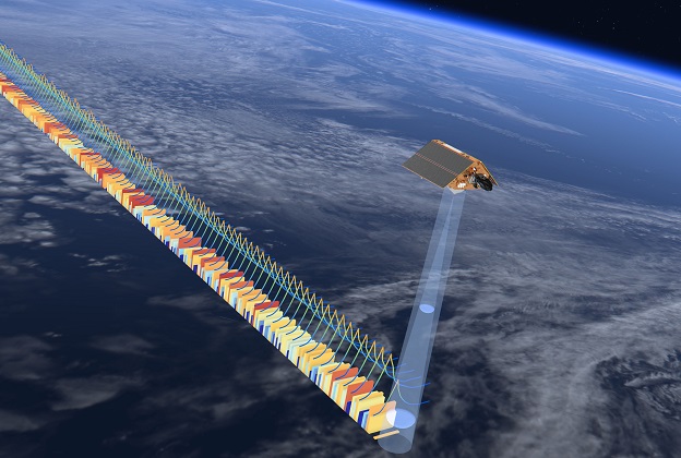
Artist’s impression of a Sentinel satellite. Courtesy ESA/ATG medialab.
European Space Agency-funded research has revealed a new way to measure sea-level change in coastal areas with millimetre-per-year accuracy. It also works for areas covered by ice.
Satellite radar altimetry data collected since 1990 has shown that the global mean sea level has risen, on average, by just over 3 mm every year… a rate that has increased in recent years.
Such averages are fine for assessments of open water regions across the globe, but measurements along coastlines are trickier due to distortions in the radar waves reflected from mountains, bays and islands.
“To protect people and infrastructure — for example by building flood protection structures, securing ports or making dikes higher — we need reliable forecasts on sea-level trends,” said Florian Seitz, Director of the German Geodetic Research Institute at the Technical University of Munich
Through ESA’s Earth Observation Science for Society Baltic Sea Level project (Baltic SEAL), a team of researchers at the Technical University of Munich worked with international partners to develop new algorithms to process data from a range of satellite altimetry sensors.
The aim of the work was to yield precise and high-resolution measurements of sea-level changes in coastal areas and the ‘leads’ in sea ice.
The researchers chose the Baltic Sea as the model region.
“Data from this region are especially suitable for developing new methods because multiple factors make analysis difficult such as the complex shape of the coastline, sea ice and wind. At the same time, there are plenty of local sea level measurements to corroborate the results,” said project leader Marcello Passaro.
“An analytical method that works in the Baltic Sea can be easily adapted to other regions.”
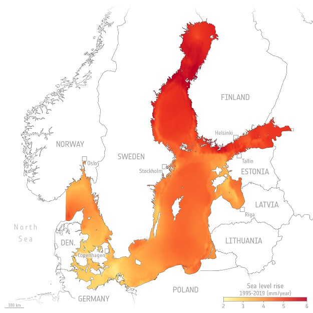
Mean sea-level rise in the North and Baltic seas (millimetres per year), calculated using satellite altimetry data between 1995 and 2019. Courtesy TUM/ESA.
The team developed a multi-stage process to handle hundreds of millions of radar measurements collected between 1995 and 2019 from missions such as the Jason series, Envisat, CryoSat and Copernicus Sentinel-3.
First, they calibrated the measurements from the various satellite missions so that they could be combined. With their new algorithms they were then able to detect signals from ice-covered seawater in the radar reflections produced along cracks and fissures, called leads.
This made it possible to determine sea levels for the winter months. And with new computational methods they also achieved better resolution of radar echoes close to land.
The data show that the sea level has risen at an annual rate of 2–3 mm in the south of the Baltic Sea, along the German and Danish coasts, compared to 6 mm in the northeast, in the Bay of Bothnia.
The cause of the larger northeasterly rise is strong south-westerly winds that drive the waters to the north and eastward.
The researchers say that above-average increase in sea level does not pose a threat to coastal dwellers, however, because the land here is rising by up to 1 cm per year as a result of post-glacial rebound.
“With the data, researchers can verify their climate models, for example, and public authorities can plan suitable protective measures,” said Dr Seitz.
Stay up to date by getting stories like this delivered to your inbox.
Sign up to receive our free weekly Spatial Source newsletter.