A weekly round-up of all the geospatial news that didn’t make it into our normal daily coverage.
If you have a Spatial Snippet to share with our readers, please send us an email.
We’ll start off this week with some drone news of interest to surveying and aerial imaging businesses. CASA is seeking feedback on a policy proposal for specific drone operations above the standard 400 ft AGL limit. The proposal would apply to activities in two particular circumstances where operations would be unlikely to conflict with crewed aircraft:
- near vertical structures, objects or obstacles, such as cliffs, wind turbines, towers or buildings; and
- over excavated pit areas within active mining operations.
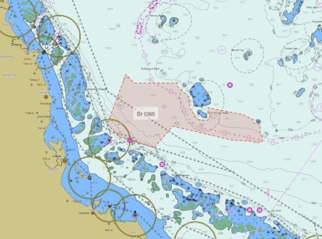
The Australian Hydrographic Office (AHO) has published the 2027 ChartScheme, being its annual charting plan. The ChartScheme outlines activities within Australian waters and the waters of those countries for which the AHO is the Primary Charting Authority. Nineteen endeavours are planned for 2027 or are already underway:
- Yampi Sound to Montgomery Reef (WA)
- The Boxers to Margaret Harries Banks (WA)
- Arnhem Marine Park (South) and Goulburn Islands (NT)
- Kent Group and Beagle Marine Park (Tas)
- Kangaroo Island (South-West) (SA)
- Palm Passage to Malay Reef (Qld)
- Arnhem Marine Park (North) (NT)
- Approaches to Maningrida (NT)
- Approaches to Port Walcott (Outer Anchorages) (WA)
- Margaret Harries Bank to Evans Shoal (East) (NT)
- The Boxers (West) (WA)
- Jabiru Shoals to Holothuria Banks (North) (WA)
- North-West Approaches to Torres Strait (Qld)
- Two Way Route: Abbot Point to Wilson Shoal (Qld)
- Dampier Marine Park (North) (WA)
- Gold Coast Seaway Extension (Qld)
- Batumata Point (PNG)
- Approaches to Larsemann Hills (Antarctica)
- S-100 Rollout – Sydney Harbour (NSW)
South Australia’s Land Services will hold a survey industry social event on 30 July (4:30pm to 6:30pm), with all interested surveyors and drafters encouraged to attend. As well as a chance for people to meet up over drinks and light refreshments, Land Services will provide information on recent updates and enhancements, and will also have two help desks set up with staff available to answer questions. RSVP by 29 July is required.
Curtin University is seeking a PhD candidate to undertake research into integrating various data sources related to Earth observations and in-situ measurements using geospatial technologies, to assess multi-hazard risks. Scholarship and internship options might be available.
The team at the Digital Atlas of Australia has announced the availability of two datasets from the Department of Climate Change, Energy, the Environment and Water that show where threatened terrestrial species’ habitats and ecological communities are located. They are the density of threatened and migratory species habitat distributions, and density of indicative threatened ecological community distributions. The information is likely to be of great value for land use planning and environmental assessments.
We reported earlier this year on how the Seabed 2030 Indo-Pacific Ocean Mapping Meeting & Data Sprint had to be postponed due to uncertainties caused by the conflict in the Middle East. Well, happily we can now report that the event is back on track at the same venue in Kuala Lumpur, but with different dates, of course — it will be held 20 to 22 October 2026. The meeting will bring together representatives from hydrographic offices, academic institutions, research organisations, industry and government agencies to share expertise and strengthen co-ordination. The Data Sprint component is intended to accelerate contributions to the GEBCO grid.
This week’s geospatial job vacancies
Here are some geospatial jobs that we’ve spotted on our journeys around the internet this week.
Starting in Victoria, there is an opening for a Lead Officer Geospatial and Data Analytics within Emergency Management Victoria. The role involves managing a team of geospatial and data analytics specialists and other personnel; providing leadership and management for work that enables the accessibility and provision of high-quality and high-value mapping and geospatial data products; and leading the team to identify potential sources of emergency sector data and develop partnerships for the provision of timely and accurate intelligence and mapping products. Applications close on 20 July.
The Victorian Department of Transport and Planning is looking for a Senior Spatial Analyst to deliver advanced GIS solutions focused on urban planning using spatial analysis, Python automation and JavaScript web applications. The successful applicant will design and maintain geoprocessing services, ETL pipelines, automated data workflows and web mapping applications, while ensuring data quality and system reliability. Applications close on 15 July.
The state’s Department of Energy, Environment and Climate Action is seeking a Senior Biodiversity Officer. A relevant degree in biological sciences or natural resource management or commensurate experience is required, and GIS skills are essential. Applications close on 15 July.
And the same department is looking for a Fire Planning Officer, a role for which an understanding of programs such as Jira and ArcGIS is desirable. Applications close on 14 July.
In New South Wales, Transport for NSW has a vacancy for a Registered Land Surveyor for a role that will involve leading and supporting cadastral surveying services for major infrastructure projects. Applications close on 15 July.
The same organisation also has an opening for a Senior Geospatial Design & Visualisation Officer to work in a team that delivers geospatial design, mapping and visualisation services. Applications close on 19 July.
There are two more Transport for NSW roles up for grabs. The first is for a Geospatial Platform Specialist who can contribute to the design, deployment, monitoring and business-as-usual operations of various spatial platforms. Applications close today, 8 July.
The second is for a Geospatial Data Developer to join a team creating, updating and maintaining key geospatial datasets and producing analytical outputs. Applications close on 16 July.
NSW Public Works is seeking an Infrastructure Property Officer to assist with land and easement acquisition negotiations with landowners, and to provide advice to clients to support their decision making and project delivery. Applications close on 14 July.
And across the ditch, the NZ Defence Force has an opening for a Geospatial Intelligence Analyst to join a team that creates geospatial and imagery intelligence products in support of NZDF and NZ government activities by analysing imagery and geospatial data using specialist software and databases. Applications close on 14 July.
Make sure you don’t miss out any geospatial news from across Australia and around the world — subscribe to our free Spatial Source newsletter, sent out every Wednesday and Friday morning.