

The NSW Spatial Digital Twin is to play a lead role in a trial aimed at protecting communities during severe weather events such as floods.
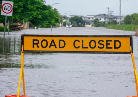
The Flood and Storm Intelligence Sensing trial will measure the propagation of radio signals across the mobile phone network — which can be affected by rainfall — and use that data to infer real-time conditions such as rainfall intensity, water levels and river flows.
That data will then be combined with historical Bureau of Meteorology data and flood information, as well as landslide data, before being presented as 4D visualisations through the NSW Spatial Digital Twin (SDT).
The visualisations will be used to not only show how the weather conditions might affect the landscape and built environment, but also to conduct insightful analytics via artificial intelligence.
The project is funded through Transport for NSW’s Smart Places Acceleration Program, overseen by the Department of Customer Service, and builds on cross-agency work on improving flood warnings and the State Disaster Mitigation Plan.
“Researching this technology is an opportunity to pioneer a new era of flood and storm intelligence,” said the NSW Minister for Customer Service and Digital Government, Jihad Dib. “The new technology will improve data-driven decision-making for first responders, filling an information gap that could make an important difference in emergency situations.”
The trial will see the NSW State Emergency Service (SES) partnering with researchers from the University of Technology Sydney (UTS) and TPG Telecom to develop and test the sensing technology. It will be the centrepiece project of the newly opened UTS-TPG Network Sensing Lab.
Testing has already begun on the Parramatta and Georges Rivers in Sydney.
“The real-time delivery of localised data from this new technology, and its capability to visualise the impacts of floods, could be applied to decisions relating to deployment of assets and personnel, warnings, evacuations, property protection, resupply and the provision of information and advice to community members,” said NSW SES Commissioner, Carlene York.
“Thanks to NSW Government support, our world-leading wireless research team, led by Distinguished Professor Jay Guo, can build on six years of research establishing the foundation for the flood and storm intelligence sensing system now in development,” added UTS Vice-Chancellor, Professor Andrew Parfitt.
“Network sensing can potentially transform the way our emergency personnel manage and mitigate flood and storm risks, but there are other applications for the technology that also will be explored in the new TPG-UTS Network Sensing Lab.”


