

The Australian & New Zealand Disaster and Emergency Management Conference will provide a forum to examine the issues surrounding natural and man-made hazards. The program will focus on Prevention, Preparedness, Response & Recovery, and will include keynote addresses, concurrent sessions, and workshops covering human and social issues, economic and environmental challenges, infrastructure, community and communication […]
Search results for "asset management"

1Spatial launches big spatial data management tool
Geospatial company 1Spatial has released an enhanced 1Spatial Management Suite, which includes Workflow, Plan, Maintain, Publish and 1Spatial Cloud. The software is aimed at public and private companies that handle high volumes of business-critical spatial data, on-premise or in the cloud. Marcus Hanke, chief executive at 1Spatial explains: “The rise and impact of big […]

NSW to view education assets spatially
The New South Wales Department of Education and Training has a new mapping interface for its Asset Management System (AMS). Developed by supplier Omnilink, the system allows users to visualise their asset data across 3,000 sites geographically. Users at the department traditionally viewed asset data on Oracle forms. Omnilink blended Oracle forms with […]

Leica and Geolantis partner for cloud based utility mapping
The Leica DX Manager simplifies utility surveying and asset management workflows.

Real-time incident capture and reporting
Cloud-based solution for crowd-sourced asset management and more.
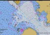
Spatial Snippets for Wednesday, 17 June
This week: Jobs for spatial analysts and GIS experts, A-SPEC events, S-100 developments and bush fire maps.

Spatial Snippets for Wednesday, 3 June
This week: Geospatial jobs around the country, upcoming events, and NSW’s new Deputy Surveyor-General.

What’s next for Pozi: Meet the team leading the way
Pozi is an Australian-owned, hosted and supported enterprise GIS application, currently trusted by more than 50 local governments across Australia. It is a hybrid cloud-based platform and delivers spatial data to users through a standard web browser, with no client software to install. Pozi is built on QGIS, an industry-standard open-source GIS, allowing clients to […]

Andrej Mocicka on 1Spatial’s merger with VertiGIS
We ask 1Spatial’s local country manager what the merger with VertiGIS will mean for Australasian customers.

Celebrating Chartis Technology’s road to success
Founded in Bathurst in 2012, Chartis Technology has expanded its offerings and its reach right across the nation.