

A weekly round-up of all the geospatial news that didn’t make it into our normal daily coverage.
If you have a Spatial Snippet to share with our readers, please send us an email.
We’ll begin as usual with some job vacancies that we’ve spotted over the past week.
In Sydney, Hornsby Shire Council is seeking an experienced Manager Strategic Landuse Planning to lead a multidisciplinary team involved in urban planning, heritage, development contributions and GIS. Applications close on 22 June.
The NSW office of Crown Lands and Public Spaces has a vacancy for a Spatial Analyst in the Bushfire Program. The role involves complex spatial modelling, bushfire spatial database development, spatial system management, technical GIS support, and staff mentoring and training. Applications close on 28 June.
In Queensland, the National Fire Ant Eradication Program is looking for a Senior Systems and Data Analyst to be responsible for developing and delivering data-driven and GIS solutions to support program intelligence functions. The role involves advanced data analysis, database management and reporting, with a focus on ensuring data integrity, quality and compliance. Applications close on 18 June.
Also in Queensland, the Department of Transport and Main Roads has an opening for a Senior Spatial Science Officer to join the Geospatial Technologies team and play a pivotal role in managing core spatial data products and be primarily responsible for road centrelines used for asset management and interactive mapping. Applications close on 26 June.
The City of Moreton Bay is looking for a GIS & Asset Data Technical Officer who enjoys a mix of office-based data work and hands-on field validation, with a passion for GIS, spatial data and asset management. Responsibilities include capturing and maintaining asset and spatial data from various sources, including as-constructed plans and ADAC files, and supporting and improving GIS data capture processes and workflows. Applications close on 23 June.
In Victoria, VicGrid is seeking a Senior Manager Land Use and Spatial Insights to lead and manage a team working across VicGrid’s business to deliver land use planning and spatial analysis insights and advice. The Senior Manager is also responsible for the establishment of VicGrid’s enterprise technical GIS frameworks and business capability, ensuring it effectively uses GIS to drive strategic outcomes with strong data governance. Applications close on 20 June.
VicGrid also is looking for a Senior Spatial Analyst to support land use assessments and spatial decision-making by undertaking a broad range of GIS tasks including cartography, data management, analysis and insights, database management and reporting. The role requires experience in geospatial modelling for delivering spatial analysis and decision support tools, and will suit a GIS professional that works effectively within multi-disciplinary teams. Applications close on 20 June.
The Victorian Department of Transport and Planning has an opening for a Data Analytics & Reporting Developer to help analyse structured, unstructured and geospatial datasets to deliver insights supporting land registry operations and decision-making, through the development of dashboards, the automation of data transformation and reporting processes, and the improvement of data quality and validation. Applications close on 27 June.
And finally, Parks Victoria needs a Program Officer Dredging and Waterway Services. The role helps keep channels, entrances and access points safe and serviceable through programmed dredging, hydrographic survey coordination, environmental monitoring and contractor management. Applications close on 21 June.
Other geospatial news
Serendipity Capital has announced it has led a $7 million seed investment in Adelaide-based QuantX Labs, a global leader in optical atomic clock technology for defence, space and critical infrastructure. QuantX Labs is one of very few companies worldwide to have taken optical atomic clock technology from prototype to revenue-generating defence contracts — including systems acquired by the Australian Department of Defence and optical clock technology recently deployed on a SpaceX mission.
GISSA has announced the return of the A-SPEC National Forum Series for 2026, bringing together practitioners from across Australia to discuss advancing digital infrastructure delivery and data excellence. The dates are:
- B-SPEC Forum: Thursday 1 October 2026
- D-SPEC Forum: Thursday 8 October 2026
- O-SPEC Forum: Thursday 15 October 2026
- R-SPEC Forum: Thursday 22 October 2026
- S-SPEC & W-SPEC Forum: Thursday 29 October 2026
- The Showcase: Thursday 5 November 2026
The Metaverse Standards Forum has announced the oddly named Sneeze, an open-source browser engine designed for spatial computing. Developed through the Forum’s Open Metaverse Browser Initiative, the project aims to provide foundational infrastructure for AR glasses, AI agents, digital twins, and spatial services before the market becomes fragmented across competing platforms.
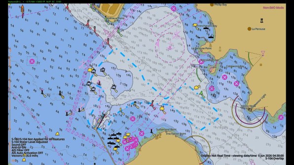
The Australian Hydrographic Office has released its first S-100 products for Botany Bay. Representing the first S-100 products in the south-west Pacific, they have been described by the South West Pacific Hydrographic Commission as a “big step forward for hydrography in the Pacific”.
The adoption of new Bush Fire Prone Land Maps continues across NSW, with the Mid-Western Regional Council advising that the updated Map for the Mid-Western Region is now in effect, following certification by the NSW Rural Fire Service Commissioner. “This updated mapping ensures we are planning appropriately for bush fire risk and protecting the community into the future. It provides clarity for landowners and developers while ensuring the right safeguards are in place,” said the Council’s General Manager, Brad Cam.
Make sure you don’t miss out any geospatial news from across Australia and around the world — subscribe to our free Spatial Source newsletter, sent out every Wednesday and Friday morning.


