


With only five months to go, delegates are encouraged to take advantage of the early bird registration rates.
Search results for "GNSS"

Dismantling surveying’s AMR shadow barriers
Surveyors Australia says the current Automatic Mutual Recognition regime is not delivering a seamless national market.

Locate26 submission deadlines fast approaching
The deadlines for Locate26 session proposals and abstracts submissions are just weeks away, so don’t delay!
Spatial Snippets for Wednesday, 20 May
This week: A cartographic scholarship, surveying and spatial jobs, and the Sentinel-2A mission is extended again.
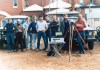
Remembering Victoria’s first GPS-enabled survey
In 1986, a small team put $90,000 GPS receivers to the test during a survey in the western districts of Victoria.

Federal budget 2026: What’s in it for geospatial?
Phil Delaney analyses the federal budget to find out what opportunities there are for the geospatial sector.
Spatial Snippets for Wednesday, 6 May
This week: Surveying and GIS jobs, navigation and SAR webinars, DEA updates, WGIC abstract call and more.

Lightweight SLAM-based LiDAR scanner
Designed for precision data capture, the Artec Jet obtains data with survey-grade accuracy, including in GPS-denied areas.
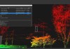
Software for 3D terrain, feature modelling
Inertial Labs claims its PCMasterPro 1.16 software has up to 200% faster processing speed.

Final GPS III satellite launched; GPS IIIF is next
The last GPS III satellite has reached orbit, as Lockheed Martin works on the next-generation GPS IIIF spacecraft.

