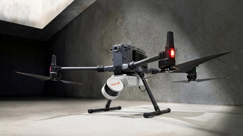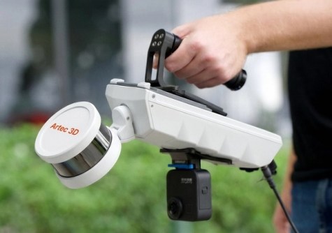
Artec 3D has released the Artec Jet SLAM-based LiDAR scanner.
Designed for precision data capture and deployable by hand, drone, vehicle, pole and backpack, the Artec Jet captures data with survey-grade accuracy, including in GPS-denied environments.
The company says the Artec Jet’s high-density LiDAR sensors and SLAM positioning enables it to capture data with an accuracy of 10 mm indoors and underground, while detecting small changes of just 5 mm. Accuracy can be further improved with the use of RTK accessories that enable GNSS-assisted georeferencing and reduce drift. It can scan fully autonomously aboard a drone, independently planning its own flight paths and able to avoid obstacles as small as 2 mm wires.
The unit has a 360° × 290° field of view, a companion app that offers real-time feedback and on-site verification, IP65 dust and water protection, an operating temperature range of -10°C to 45°C and a mass of only 1.57 kg.