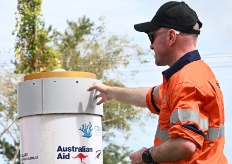
Surveyors and geospatial specialists from government agencies across the Pacific met recently for hands-on training on GNSS technology.
The aim of the five-day event in Fiji was to boost the participants’ skills and thereby help their countries to manage land, plan for disasters and monitor coastlines.
The training concentrated on operating and maintaining GNSS equipment and was the first regional event of its kind in the Pacific.
“What I learned here will help us update our topography maps which date a few years back now,” said Esther Kase, PNG National Mapping Bureau’s participant.
Practical surveying and GNSS training
The GNSS training was provided by technical experts from regional and international partner organisations, including the Pacific Community (SPC) and Geoscience Australia, with support from the Climate and Oceans Support Program in the Pacific (COSPPac).
COSPPac also provided the specialised equipment, giving participants hands-on practice.
“The hands-on experience has really boosted my confidence, and I can see how it could help address Tonga’s surveying backlog, which has been an ongoing challenge, especially as surveying is becoming a declining profession,” said Ansela Fifita from the Ministry of Lands, Survey, Spatial Planning & Natural Resources, Tonga.
“I hope we can apply what we’ve learned from this training to improve surveying practices and make better use of this technology in the future.”
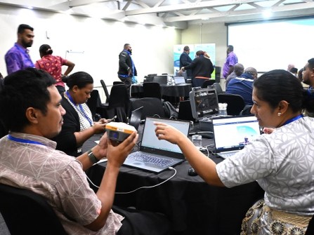
During field exercises, participants gained experience in operating CORS and RTK systems and were encouraged to explore practical applications in cadastral surveying, coastal monitoring, vertical land motion studies, and disaster risk mapping.
The participants established survey benchmarks, conducted control surveys, connected to CORS services, collected and verified field data, and carried out data processing and reporting.
Strengthening professional networks
The exercises demonstrated how RTK GNSS can support national geospatial work and decision-making.
“Everyone was very focused and keen to learn,” said trainer Kris Halewood, Operations Officer at Geoscience Australia.
The training also strengthened professional networks across the region, connecting GNSS practitioners from different countries who can continue to support one another.
“At SPC, we often speak about the importance of ensuring that the investments we make are useful, usable and used,” said Zulfikar Begg, Project Manager, COSPPac, SPC.
“This is a guiding principle of COSPPac and one that is particularly relevant to the work we are discussing [here].”
Related news:
GIS professionals gather for Pacific environment action
Pacific experts gather to discuss LiDAR needs
Advancing geospatial strengths in the Pacific
Geospatial training for Solomon Islands officials