Pacific nations unite to strengthen geospatial infrastructure and build surveying leadership.
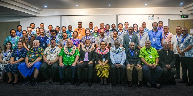
The 7th Pacific Geospatial and Surveying Council (PGSC) Meeting has been underway this week in Nadi, Fiji.
The event has brought together the leaders of geospatial and surveying departments from 14 Pacific Island nations, alongside regional and international partners such as Surveyors Australia, Geoscience Australia and Land Information New Zealand.
The three-day meeting, running from 15 to 17 April, is reviewing the PGSC Strategy as the Council looks beyond 2027, assessing progress across its three Working Groups (Positioning, Policy and Data Management, and Capacity Development), and electing new leadership to guide the Council into its next phase.
Operational reality
Fiji’s Minister for Lands and Mineral Resources, Filimoni Vosarogo, opened the meeting with a direct call to action, urging Pacific nations to “secure the geodetic backbone of our future.”
The Minister emphasised that geospatial science and surveying are foundational infrastructure for resilience, sovereignty and sustainable prosperity across the Pacific.
Minister Vosarogo called on delegates to move regional cooperation from goodwill to operational reality, warning that major geospatial investments such as LiDAR campaigns and satellite mapping must be designed to build enduring local capacity, not simply pass through national institutions.
The Minister also highlighted the critical need for leadership and management capability across the Pacific surveying profession, noting that technical excellence alone is not enough.
The Minister said that a new generation of geospatial leaders is needed to translate data into policy, negotiate with international partners, and champion investment at the highest levels of government.
Supporting sustainable development
Surveyors Australia CEO Michelle Blicavs attended the meeting as a PGSC partner and delivered a management training session on Day 2, directly addressing the leadership development priorities identified by Minister Vosarogo.
“Surveyors Australia is proud to support the PGSC and contribute to building leadership capability across the Pacific surveying profession,” said Blicavs.
“The Minister’s call for disciplined, coordinated execution resonates strongly with the work we are doing to strengthen the profession nationally and regionally.”
PGSC Chair Vaipo Mataora, Deputy Secretary of the Ministry of Infrastructure Cook Islands, reaffirmed the Council’s long-term goal — that Pacific Island geospatial and surveying services are sufficiently resourced to respond to national needs and support sustainable development.
Key themes across the three-day program have included climate resilience, maritime boundary delimitation under UNCLOS, gender equality and social inclusion (GEDSI), and the development of a Pacific-endorsed site prioritisation framework for LiDAR data acquisition.
A separate one-day Regional LiDAR Consultation Workshop will follow on 20 April, supported by the Weather Ready Pacific program.