

Members of the ADF’s Maritime Geospatial Warfare Unit recently undertook two weeks of training in northern Sydney.
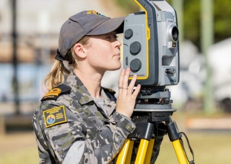
Personnel from the MGWU’s outstations in Cairns, Sydney and Nowra gathered for what the military calls a ‘force generation activity,’ which involved testing various aspects of underwater surveying and geospatial intelligence gathering.
The two weeks of field activities were conducted at Pittwater, about 40 kilometres north of the Sydney CBD, and involved the team members put their expertise and equipment to the test in scenarios that combined proven hydrographic survey techniques with emerging geospatial intelligence capabilities.
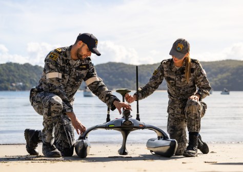
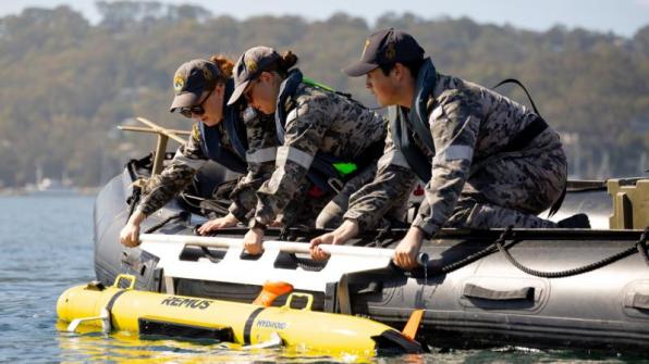
Equipment used included ‘fly-away’ survey kits, Sonobot uncrewed surface vehicles, and REMUS and Gavia autonomous underwater vehicles.
The realistic training enabled members of both the Deployable Shallow-water Survey Team (DSST) and the Deployable Geospatial Survey Team (DGST) to work together to enhance geospatial intelligence collection.
Decision-ready products
According to Lieutenant Commander Mathew Nichols, the two-week endeavour demonstrated the MGWU’s growing capabilities, especially in the operation of autonomous systems.
“DSST’s confidence with autonomous systems such as the REMUS 100S, Gavia AUV and Sonobot significantly increased during the activity,” he said.
“Young sailors were able to demonstrate their ability to plan and execute autonomous missions while remaining clear of simulated threats, in both day and night conditions.”
The large volumes of data acquired were of use both in improving tactical decision-making, and in forging a greater understanding of the kind of geospatial intelligence that is available.
“Autonomous missions produced terabytes of data, enabling DSST to identify undersea infrastructure and support navigational freedom of manoeuvre,” Lieutenant Commander Nichols said.
“Importantly, this data was converted into decision-ready products for command, while AUV-collected oceanographic data was integrated into broader geospatial outputs.”
A team effort
Lieutenant Ayla Williams, a member of the DGST, said the activity had value both in validating the teams’ capabilities, and in boosting team performance while working alongside colleagues in the DSST.
“The evolving nature of the battlespace demands continuous advancement in our military hydrographic practices,” Lieutenant Williams said.
“Observing how DSST approach and solve challenges has enabled DGST to adopt alternative problem-solving methods.”
“While our approaches to understanding the water column and seabed differ, we ultimately operate in the same environment, and it has been highly valuable to see their capability in action,” Lieutenant Williams said.
“We are now exploring the development of in-house solutions to support the deployment of both DSST and DGST assets across multiple platforms in a modular, scalable package. This includes an internal trials program for Jet RHIB [rigid-hulled inflatable boat] survey systems employment.”
The two-week session also involved contributions from the Mine Warfare, Clearance Diving and Geospatial Force, the Maritime Geospatial Training College, and the newly established Maritime Autonomous Systems Unit.
See also:
PNT assurance in the age of NAVWAR
International Women’s Day 2026 interview: Charlie-Elle McCarthy


