A weekly round-up of all the geospatial news that didn’t make it into our normal daily coverage.
If you have a Spatial Snippet to share with our readers, please send us an email.
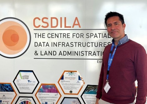
We’ll start off this week with news that Dr Rolando Chacón, Associate Professor at the Universitat Politècnica de Catalunya (UPC), Barcelona, has been welcomed to the Centre for Spatial Data Infrastructures and Land Administration (CSDILA) at the University of Melbourne.
Dr Chacón’s visit will boost collaboration between UPC and CSDILA in the area of interoperable digital twins for infrastructure and cities, focusing on semantic frameworks and knowledge graphs that connect BIM, reality capture, structural analysis, GIS, and city management models, with validation through case studies in both Australia and Spain.
The South West Pacific Hydrographic Commission (SWPHC) has announced the establishment of the Hydrographic Surveyors Working Group (HSWG). The HSWG will support the development of a regional network of hydrographic surveyors, promote professional development and mentoring opportunities, and identify capacity and capability development initiatives across the South West Pacific.
Although the group will initially be focused on participation from SWPHC members, there is potential to broaden engagement with industry partners in the future to further strengthen collaboration across the hydrographic community.
The Australian Bureau of Statistics has released the first part of the 4th Edition of the Australian Statistical Geography Standard (ASGS), in time for the 2026 Census on 11 August. At the heart of the ASGS is the Mesh Block, with 8,889 new Mesh Blocks bringing the total to 374,917. According to the ABS, the ASGS is a “classification of Australia into a hierarchy of statistical areas. It is a social geography, developed to reflect the location of people and communities. The ABS use it to publish and analyse official statistics and other data. The ASGS is updated every 5 years to account for growth and change in Australia’s population, economy and infrastructure.”
Two staff members from NSW’s DCS Spatial Services have had a paper published in Coordinates magazine. Michael London and Dr Volker Janssen’s paper, ‘Permanent survey marks in New South Wales, Australia’ traces the journey of a permanent survey mark from manufacture and number allocation, through distribution and locality sketch plan preparation, to its first digital appearance on public record in the Survey Control Information Management System. NSW’s survey control network currently has 250,000 survey marks.
Survey and Spatial New Zealand will conduct a webinar on 26 August titled, ‘Starting a Geospatial Business in New Zealand,’ which should be of great interest to those who want to turn their world-changing new idea into a going concern. The presenter will be Maksym Khovalko.
New Zealand’s Kairūri Community Trust has announced that applications are open for the 2026 Stirling Scholarship, which aims to support a student enrolled in a surveying, spatial or GIS related course at a New Zealand university or other New Zealand tertiary institute. The scholarship includes a NZ$2,500 cash award, attendance at the 2026 Survey and Spatial New Zealand annual conference in September, and the opportunity to make a short presentation at the conference.
On the topic of scholarships, University of Southern Queensland surveying student, Joshua Cranage, has been awarded an Elite Athlete Scholarship. Cranage is a cycling enthusiast who won the Australian Under 19 Road Race Championships in 2023, which led to a European campaign and earned him selection on the Australian team for the UCI World Championships in Glasgow.
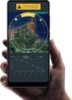
And the Pacific GIS and Remote Sensing Council has added another institutional member. Founded in New Caledonia in 2025, Tauhã is a climate-tech start-up dedicated to building a network of virtual environmental monitoring stations powered by satellite Earth observation and artificial intelligence. The company is involved in monitoring:
- Coastal erosion and shoreline change
- Sea-level rise and coastal hazards
- Water quality monitoring
- Human activities and land-use change
- Environmental compliance and ecosystem monitoring
This week’s geospatial job vacancies
Here are some geospatial jobs that we’ve spotted on our journeys around the internet this week.
Starting New South Wales, and Transport for NSW has an opening for a Senior Network & Geospatial Analysis Specialist to lead the delivery of high-quality geospatial analysis, GIS mapping, network performance reporting and data-driven insights, while developing innovative analytical tools and supporting the ongoing uplift of capability across the organisation. Applications close on 4 August.
Transport for NSW also has an opening for an Associate Geospatial Data Developer to be involved in supporting geospatial data management and analytics, with a key focus on maintaining and updating road network data, while also supporting the development of maps and applications. Applications close on 31 July.
And the same organisation has a vacancy for a Business Intelligence Specialist. The role requires strong expertise in BI development, data modelling, analytics and data visualisation, and an understanding of spatial data concepts, including geospatial formats and projection standards. Applications close on 27 July.
The NSW Department of Climate Change, Energy, the Environment and Water has four roles up for grabs. The first is for a Senior Geospatial Analyst to join the Renewable Energy Biodiversity Support team to lead the development and delivery of spatial data products, GIS analysis and technical reporting, while managing complex spatial datasets, implementing quality assurance processes, contributing to technical projects and providing specialist GIS advice. Applications close on 3 August.
The second role is for a number of Spatial Data Officers to join the National Parks & Wildlife Service and work on the Spatial Modernisation Project, which will involve improving field tools, upgrading critical datasets and building user-friendly web-based GIS apps used by over 2,000 staff across the state. Applications close on 9 August.
The third role is for a Senior Scientist Adaptation to lead the development of scientifically robust methods and analysis to use climate projections to inform risk assessments and adaptation planning for the built environment. Experience using geospatial data and GIS for climate analysis and hazard mapping is a desirable quality for this role. Applications close on 13 August.
And the fourth role is for a Scientist – Wetland Ecosystem Modeller to join the Water Wetlands and Coastal Science Branch. The job will involve developing advanced modelling, remote sensing and spatial analytical tools that improve understanding of wetland hydrology, ecosystem processes and ecological responses. The role requires working with high‑performance computing environments, Python‑based analytical workflows, satellite and drone imagery, and diverse environmental datasets. Applications close on 4 August.
In Queensland, the Department of Transport and Main Roads has an opening for a Manager (Technical Services) to be responsible for ensuring the availability of technical capacity, capability and governance support across the technical functions of design, geospatial services, materials testing, cultural heritage and environment, and workplace health and safety. Applications close on 4 August.
The Queensland Department of Natural Resources and Mines, Manufacturing and Regional and Rural Development has a vacancy for a Senior Spatial Information Officer to provide specialist spatial support, maintain cadastral data within the Queensland Spatial Cadastral Fabric, and collaborate with government and industry stakeholders. Applications close on 28 July.
In Western Australia, the Department of Biodiversity, Conservation and Attractions has a couple of roles going. The first is for a Fire Operations Officer to be responsible for planning, organising, training and implementing programs and operations relating to fire management, and to monitor and manage the District GIS database. Evidence must be provided of the ability to use various software and GIS. Applications close on 10 August.
The second role is for a Conservation Operations Officer (Fauna). Applicants will need to demonstrate experience in collating and analysing data, managing datasets, and using computer skills for report writing, spreadsheets and creating databases, integrated with GIS applications for landscape mapping. Applications close on 6 August.
Across the ditch, the NZ Defence Force is looking for a Geospatial Intelligence Team Lead to lead and develop a team of GEOINT professionals, deliver high-quality geospatial and imagery intelligence products, drive innovation and modernisation of GEOINT workflows and capabilities, and represent GEOINT New Zealand at national and international forums. The application deadline is 30 July.
And the Pacific Community is seeking a Platform Engineer to work with Digital Earth Pacific for three years, based in New Caledonia. The role involves providing technical direction and hands-on platform engineering to operate, maintain and continuously improve the Digital Earth Pacific cloud-native infrastructure and services. Applications close on 26 July.
Make sure you don’t miss out any geospatial news from across Australia and around the world — subscribe to our free Spatial Source newsletter, sent out every Wednesday and Friday morning.