Port of Auckland is using SouthPAN for positioning accuracy and to help ensure safety and efficiency
Positioning information accuracy matters a great deal in busy ports, where maritime pilots and port operators make decisions every day that can have immediate safety, environmental and infrastructure consequences.
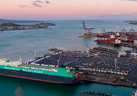
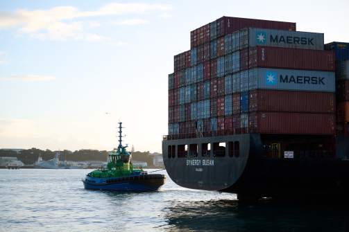
At Port of Auckland, pilots conduct around 2,500 pilotage acts each year, guiding vessels that range in size from 40-metre-long superyachts to 300-metre-long container ships and cruise liners.
Complicating matters is that the harbour’s commercial berths are orientated north to south, while the wind and tide run across them.
Pilots often need to move large vessels through narrow spaces, manage crosswind and cross-tide effects, and berth with limited under-keel clearance.
SouthPAN’s resilient extra layer
Port of Auckland uses RTK GNSS positioning using LINZ PositioNZ-RT as its preferred correction source for their Portable Pilot Units (PPU). RTK provides centimetre-level performance where available, making it well suited to high-precision pilotage requirements.
SouthPAN is the free public space-based augmentation service delivered in partnership by the New Zealand and Australian governments.
It adds value for the Port by providing an independent, satellite-delivered correction source that can support sub-metre positioning if internet-delivered PositioNZ-RT data is unavailable or disrupted.
This means SouthPAN can act as a resilience layer within a blended positioning model, rather than replacing the port’s preferred RTK solution.
Michael Appleyard, Head of Location Information at Toitū Te Whenua Land Information New Zealand (LINZ), says the Port of Auckland provides a practical example for other maritime operators considering SouthPAN.
“The lesson from Port of Auckland is that SouthPAN does not need to replace existing positioning systems to provide practical value,” he said.
“In critical environments, an independent satellite-delivered correction source can strengthen the overall positioning capability and confidence of pilots, giving them another layer of resilience to work with.”
Boosting positioning confidence at Port of Auckland
Port of Auckland uses SouthPAN right across its Channel Pilot and AD Navigation XR2 PPU fleet. These PPUs are used on every pilotage, providing vessel-independent positioning and electronic chart display for pilots during operations.
For pilots, the operational value is confidence. Pilotage involves constrained channels, dynamic manoeuvring and tight berthing environments. Any additional positioning uncertainty can increase operational risk.
By adding a satellite-delivered correction source alongside internet-delivered RTK, SouthPAN supports a more resilient approach to corrected positioning.
“We want to use the best positioning available to help ensure safety and efficiency,” said John Barker, Senior Pilot at Port of Auckland.
“SouthPAN supports that by adding resilience to our positioning approach.”
Further improvements to come
For other ports and maritime operators, the key question is not whether SouthPAN improves accuracy over standard GPS. It is whether SouthPAN can strengthen the overall positioning model for the operation.
Practical adoption steps include checking whether existing receivers or PPUs are SBAS compatible, confirming vendor support, reviewing firmware and configuration, testing performance in the intended operating environment, and setting clear procedures for when each correction source should be used.
A future area of interest for Port of Auckland is SouthPAN’s Precise Point Positioning Via SouthPAN, or PVS service, subject to PPU vendor support and operational validation.
This service will be freely available and aims to deliver decimetre level accuracy and precision for users as the SouthPAN system matures overtime.
Related articles:
LINZ offers no-cost way to trial SouthPAN