

SouthPAN is seriously boosting mapping and GIS accuracy for New Zealand’s Bioeconomy Science Institute.
The Institute’s remit includes managing forest inventory, keeping track of pests and diseases, and supporting precision forestry operations.
As accurate positioning is crucial for the Institute’s success, it wanted to see if SouthPAN could make a difference.
SouthPAN, or the Southern Positioning Augmentation Network, is a space-based augmentation system that vastly improves the accuracy obtainable from the various GNSS such as GPS.
A joint Australia/New Zealand project, it is being led by Geoscience Australia and Toitū Te Whenua Land Information New Zealand (LINZ).
The problems of pre-SouthPAN workflows
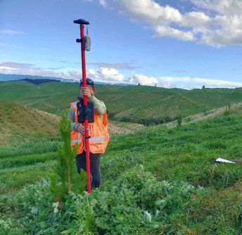
The Bioeconomy Science Institute Maiangi Taiao makes use of a wide variety of equipment and workflows that rely upon precision positioning, such as field mapping and UAV-based aerial imaging.
Traditional positioning technologies such as handheld GPS units often can provide accuracy of only 15 metres in some challenging forestry environments.
Utilisation of other systems such as RTK or higher-grade GPS units dramatically increases capital and ongoing costs.
There are also the problems of sometimes-long acquisition times — which means more time spent in the field — and inconsistent data quality due to variable positioning performance.
That’s where SouthPAN comes in.
SouthPAN makes precision forestry more accessible
The Institute put SouthPAN to the test using a low-cost GNSS receiver to see how its performance would compare with traditional systems.
The evaluation showed that using the low-cost unit with SouthPAN can, for the Institute’s purposes, give results comparable with more expensive systems.
Importantly, the combination resulted in sub-metre accuracy.
This means the Institute has been able to capture more data, more quickly.
“SouthPAN can help turn precision forestry into a more accessible and more scalable capability across forestry operations,” said Peter Massam from the Bioeconomy Science Institute.
Other benefits include being able to standardise workflows, cutting point acquisition from three minutes to 20 or 30 seconds, and speeding up of data collection by three to five times.
“SouthPAN delivers a quicker, more precise location in less time, with little to no post-processing,” added Massam.
See also:
Otago Council puts SouthPAN’s L1 SBAS to the test


