

The ICA and OGC are collaborating to improve cartographic design and develop interoperable mapping standards.
The diversity of technologies we use to collect, handle and visualise geospatial data and the range of application domains to which geospatial solutions are applied are, on the one hand, an exciting aspect of our industry, and on the other hand, one of its big challenges. It can sometimes be difficult to make multiple technologies work together to solve a particular domain problem.
The Open Geospatial Consortium (OGC) is one organisation that arose in part to address some of these challenges. It has a long history of co-operation between government, industry and academic organisations to develop standards that help make geospatial technologies work together, providing people with better access to location information.
A key to many of its successes has been the co-operative development of standards that make geospatial technologies interoperable, and we can thank these standards for making it easier for geospatial professionals to build custom geospatial solutions using technologies built by different organisations. Although many jobs touch ‘raw’ geospatial data in one form or another, an even greater number of people interact with geospatial data through the form of maps, with no idea whatsoever about the data that lies beneath.
Yet sometimes the geospatial software used to produce these maps is designed by developers with little background in cartography, resulting in maps that could be greatly improved. It’s hard to fault developers for this, though, as much cartographic design knowledge remains inaccessible, locked in the minds of cartographers, and is not necessarily in a format that is easy for software developers to understand.
Working together
In 2019, a group of cartographers who were collaborating through the International Cartographic Association’s (ICA) Commissions (introduced to Spatial Source readers earlier this year) wondered why more cartographers were not involved in OGC activities. We convinced the ICA Executive Committee of the importance of engaging with the OGC, and the ICA joined the OGC as an Associate Member in 2020. Our group began by starting to explore some ways in which we could make cartographic knowledge understandable for more people.
Like the ICA, the OGC is a large organisation composed of people with varying interests. Much of the work of the OGC happens in its Domain Working Groups, which are focused on different thematic and application areas. Some of these areas are quite focused, while others cut across multiple domains and technology types. One of these cross-cutting areas and one of the most obvious touch points for ICA was to get involved with the OGC’s Portrayal Domain Working Group, which focuses on how geospatial information is presented to its human users, often, but not exclusively, in the form of maps. The group also addresses newer forms of visualisation like 3D visualisation, augmented and virtual reality, and gaming and simulation.
We looked at the work the DWG was already doing and our attention was caught by a quote from the 2018 Roadmap for the Portrayal DWG: “As part of this study, it was observed that there was a lot of frustration with what is considered poor cartographic practices. OGC is in a position to do something about this. It is not just a standards body, it is also a group of highly respected geospatial experts. The group should look for opportunities to identify and promote good cartography.”
OGC’s initial work in developing a Portrayal Standard (SymCore 1.0) focused on low-level details, like making sure symbol elements such as colours, fills and strokes are interoperable and can be reproduced accurately in different software systems. By intent it didn’t provide much guidance on what comprises ‘good design’. This latter effort seemed like a place where ICA members could contribute.
Initial steps
This led to our first explorations, where we examined what might be some of the barriers and solutions to making cartographic knowledge accessible to software developers. We held a workshop to discuss these ideas at the 2021 International Cartographic Conference (ICC) in Florence, Italy, and later presented our initial ideas to the Portrayal DWG members at one of their meetings to get feedback and gauge their interest in working together. We also began sending cartographers to OGC meetings to see what was else was being discussed.
The collaboration has been multidirectional. In 2023, the OGC sent two members to the ICC in Cape Town, South Africa, where one of them presented on the current work on the Portrayal Standard. SymCor 2.0 aims to try to implement some ‘good design’ guidance into the standard. We took advantage of the conference to get a wider array of cartographers from different countries to contribute to the project and we discussed pragmatic ways that cartographers could contribute to the Portrayal Standard. One practical action we identified was in developing a collection of good practice examples that could be used to illustrate some aspects of the standard and against which to test the proposed SymCor 2.0 standard.
Current work
From these interactions, we decided to work on developing an OGC technical paper, and our initial ideas for that paper were shared at OGC meetings in 2023. Technical papers take research and explore how it might be applied in operational practice. In the paper we aimed to identify areas of cartographic design where there are not even de facto standards, to identify areas of cartographic practice that could benefit from standardisation, and to consider the limits of standardisation.
We identified four main areas of interest: geospatial semantics/terminology and applied ontology; good cartographic practice in different map use contexts; 3D and immersive cartographies (VR/AR); and visualising big geospatial data. Our intent is for the technical paper to provide a high-level synthesis of relevant cartographic research and design recommendations for software developers.
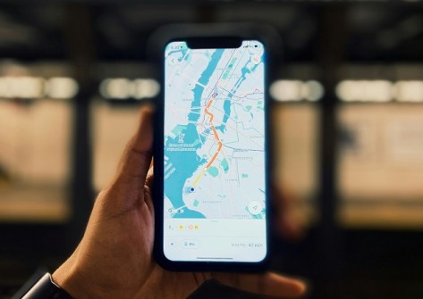
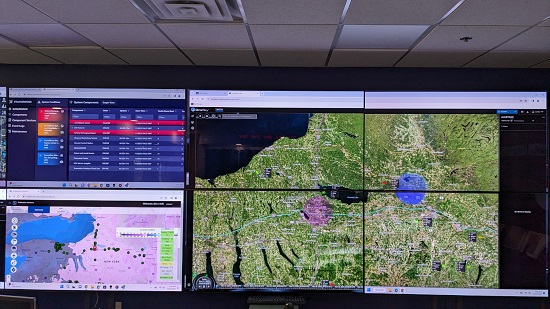
Let me give you one example from that work related to good practice and map use context. A challenge of cartographic design is that it is context-specific — the map you design for the small screen of a mobile phone that will be used in bright daylight is not the same map you would design for a huge wall display in an emergency operations centre. A skilled cartographer will recognise relevant context elements and adjust their design to accommodate the use context.
The importance of context means that a too-narrowly focused standard is doomed to failure, as it doesn’t take these context factors into account. But it’s also impossible to design a standard for every situation as there are too many impactful context elements that can vary, and many design decisions are trade-offs.
A step towards solving this problem could be the development of design patterns along with the automatic sensing of (at least some) context elements, which could determine which of the design patterns to use for the given context. A relatively simple example of this might be sensing the screen size, display resolution and display brightness to determine minimum element sizes and contrast levels for legibility within a map. Design patterns could suggest good starting points for meeting these design requirements for different display sizes (e.g. desktop, laptop, mobile) and different screen technologies (e.g. LED, LCD).
Want to get involved?
The work described above is one that cuts across several topic areas that the ICA addresses: cartographic design, how people understand maps, standards, open-source geospatial software, geospatial semantics, and augmented and virtual reality. If it sounds like something you’d like to be involved with, please reach out to me (amy.griffin@rmit.edu.au) and I will connect you with the right people. And if you have an example of a map that you think represents good cartographic practice and that you’d be willing to contribute to the effort, that would be one easy way in which you could get involved.
Amy Griffin is a Senior Lecturer in Geospatial Sciences at RMIT University and current ICA Vice President. She would like to acknowledge colleagues working on the context project — from the ICA: Serena Coetzee (University of Pretoria, ZA), Petr Kubicek (Masaryk University, CZ), Silvana Camboim (Federal University of Paraná, BR), Dalia Varanka (USGS, USA), Francis Harvey (Leibniz Institute for Regional Geography, GER and University of Warsaw, PL), Franz-Josef Behr (Stuttgart Insitute of Applied Sciences, GER), Barend Köbben (University of Twente, NL) and Reese Plews (Plews Consulting, JP); and from the OGC: Keith Ryden, Iain Burnell, Gobe Hobona, Jerome Jacovella-St-Louis.


