

The hugely successful MAGNET Office CAD workflow solution will soon be upgraded to version 9.
PARTNER FEATURE
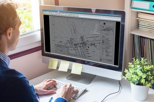
Relied upon by cadastral and topographic surveyors, engineers, architects and drafters, computer aided design (CAD) survey software is used to create and manage plans or projects in a digital format.
The software available on the market today has come a long way from the early years of computer programs. In this article we’ll step through the evolution of the software now known as MAGNET Office, previously civilcad and before that CivilDes. Widely used in Australia and New Zealand, the program continues to be developed in Australia by Topcon software engineers, working alongside the global Topcon network that employs some 200 software developers.
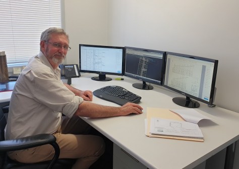
Cliff Stewart is a land and mine surveyor with more than 30 years’ experience in land development projects. During his career, he’s also worked on 13 mine sites and is authorised for all aspects of underground and open pit mine surveying.
As the founder and managing director of Stewart Surveys, which was established in 1985 in Gunnedah, New South Wales, Cliff remembers his first purchase of a CAD program that same year — CivilDes, which had been launched circa 1982 as a level book reduction program.
Remember floppy disks?
“The computer came with the software and had virtually no memory,” he recalls. “The software was on 5.25-inch floppy disks. Every time you used it, you had to put in a floppy with program files and then another to store your data because the computer wasn’t able to store either,” he added.
The crisp, multi-coloured graphics surveyors are accustomed to today were certainly not available in the early days.
“There wasn’t much in the way of graphics,” Cliff said. “It basically calculated and plotted closes, long sections, cross sections and so on.”
Data collectors for use in the field were large and cumbersome. “My first plotter was an A3 tablet. We used to stick the A3 plans together and trace the final,” Cliff said. “In 1986 we bought a Housten pen plotter — it only held one pen and you had to change it to get different thicknesses.”
civilcad version 5 is a step change in CAD software
Between 1985 and 1990 there were some rapid developments in computer memory capacity, with the ability to store megabytes of data. The name CivilDes was changed by the developer Peter Bloomfield to civilcad in 1985. In 1996 Topcon Positioning Systems purchased the program and retained the development team.
Cliff remembers civilcad version 5 as a major change to the software structure. “Version 5 was very good software for the time and we used it on a lot on large jobs,” he said. “It had a new file structure compared to version 4 and it was supplied on 3.5-inch floppies.”
Adam Burke, Geospatial Business Manager for Aptella (formerly Position Partners), which sells and supports the software in Australia and New Zealand, remembers the challenges of supporting customers in his early days with the company.
“I joined when we were shipping 3.5-inch floppies,” he said. “We used to have to cut those floppies by hand; it took ages to produce all the disk sets to send to customers when there was an update. How times have changed now with customers just downloading updates when they want to in a few minutes.”
The move to version 6 in 2002 was a challenging time for the software, Cliff recalls, as the platform moved from DOS to a Windows environment. Many customers chose to stick with the robust version 5 until the bugs had been worked through.
Version 7 was the first full Windows-based upgrade, released in 2010. Like version 5, it was a very stable platform that surveyors and engineers relied on for many years, often foregoing further updates.
In 2013, Topcon changed the brand from civilcad to MAGNET, bringing in a new era of modular application-based solutions and integration between field, office and enterprise project management tasks.
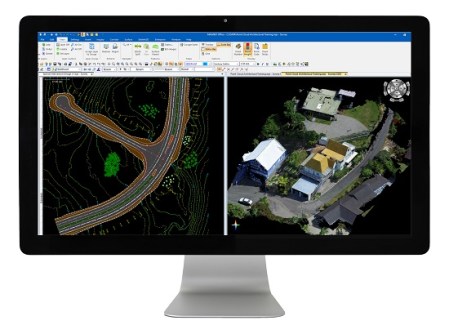
Fast-forward to the present, and MAGNET is a complete workflow solution that enables collaboration across multiple teams and stages of a project. Used by land surveyors, mine surveyors, engineers, project managers, building trades and more, the interface now has more than 10 modules that can be used for layout, data collection and large infrastructure 3D site management, to name just a few applications.
In recent years, the platform has evolved further still, with cloud computing enabling network licensing and the ability to import and work with large data files in many formats.
Graeme Hetet specialises in MAGNET Office support as a Customer Success Manager for Aptella, based in New Zealand. His experience with the platform goes back to the 1980s when he managed CAD designs for a local authority.
“I too remember the Houston 4 pen plotter — at the time we were all amazed by its capabilities to change pens for different thicknesses, tracing paper going back and forth!” he said.
Having served customers since the early 1990s with support for civilcad, now MAGNET, Graeme says the software is far more user friendly and powerful.
“A lot of manual process and tasks that would take a lot of clicking around, can now be done effortlessly with a single click,” he said. Examples include the interactive road corridor design module that automatically recalculates volumes without manual adjustments, and the ability to work in other modes without changing screens, such as Layer Manager and Property Manager.
Many features, Graeme explains, have come about in direct response to user input. Recent examples include plotting enhancements, an as-designed, as-constructed module, and the ability to import point cloud data.
“I think one of the reasons it continues to be a preferred software choice for surveyors is because of the close working relationship the Aptella team has with both end users and with Topcon’s development team,” he said. “We advocate for our customers in Australia and New Zealand to get their feedback heard and requests incorporated into future releases wherever possible.”
Later this year, the MAGNET name will be phased out with the release of Version 9, unifying the software suite under the global Topcon brand.
“It may come as a surprise to some users that Topcon is behind the MAGNET software suite, and has been for decades,” Adam said. “Many think of the company as a hardware manufacturer, but software is at the very heart of almost all products they design.”
“The software users continue to rely on for their day-to-day CAD work has undergone multiple improvements and name changes over the years,” he continued. “The team behind the scenes, however, has been Topcon software developers since the mid-90s, continuing to innovate locally here in Australia, with the backing of a global team.”


