

Queensland’s Department of Resources is seeking commentary on the latest draft Cadastral Survey Requirements.
Drones employed for mapping national ecosystem
By jnally on 18 September, 2024The Terrestrial Ecosystem Research Network is conducting a nationwide ecological data collection program.
GIS solution helps manage fibre network operations
By jnally on 17 September, 2024The solution from The Spatial Distillery Company is helping Torus Networks optimise and manage its infrastructure.
Elders, SmartSat CRC sign agriculture EO MOU
By jnally on 16 September, 2024The partners have teamed up to address challenges in emissions monitoring, pest management and crop yield.
Latest Galileo navigation satellites now operational
By jnally on 11 September, 2024Three months after launch, satellites 29 and 30 have reached their target positions at an altitude of 23,222 km.
Fathom provides flood data for Australian agencies
By jnally on 11 September, 2024Geoscience Australia has licensed river, rainfall and coastal data from the UK-based risk intelligence firm.
Latest Geospatial News
View all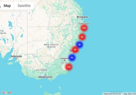
The map shows the 15,000 hectares that have been acquired and protected over the past 52 years.
 2025-02-05
ADVERTISEMENT
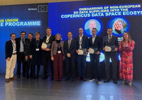
Planet’s SkySat imagery will sit alongside ESA’s Sentinel satellite data within the Copernicus services.
2025-02-04 
Free Dragonette satellite imagery will be offered under the CC BY 4.0 creative commons license.
2025-02-04 
The early bird registration deadline for the combined conferences has been extended to 17 February.
2025-02-04 
Harris will become CEO of the geoscience agency in February, replacing the retiring James Johnson.
2025-02-03 
Veris says the $3m deal will result in GIS service offerings that will enhance the overall service portfolio.
2025-01-31
ADVERTISEMENT

RMIT, Skykraft and Indian researchers are exploring microcombs as a low-cost alternative PNT technology.
2025-01-29 
- Sponsored Content
Aidedo was founded based on the practical experience of CEO Aiden Tong while studying and working with many Civil Engineering and Land Surveying firms in developed countries.
2026-06-02
The combined bodies aim to advance research and collaboration in positioning, navigation and timing.
2025-01-29 



Events
View All-
Nov 9
2026 Advancing Earth Observation Forum
 Hobart, Tasmania
-
Nov 10
SouthPAN Industry Day
Online -
Nov 13
South West and Great Southern Surveyors Conference
Mantra Bunbury Lighthouse, Bunbury, WA -
Nov 24
Locate26 Conference / 10th Digital Earth Summit
Melbourne Convention & Exhibition Centre -
Nov 30

