Australian backhaul and fibre optic network-based communications company, Torus Networks, has deployed a GIS solution to help optimise and manage its network.
The company selected the NetworkAccess Fibre Network Management solution from The Spatial Distillery Company for its scalable geospatial capabilities and ease of integration.
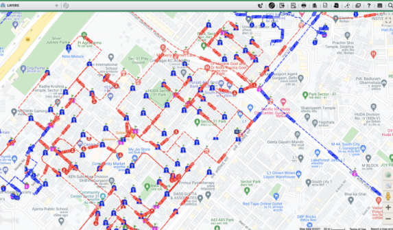
Torus Networks is using NetworkAccess to map the precise location of their fibre network infrastructure.
Using the solution’s GIS interface, Torus Networks has developed a digital twin of its network to boost accuracy in real-time asset tracking, improved troubleshooting and fault detection and optimised the network for planning and maintenance purposes.
“We’re excited to collaborate with Torus Networks to streamline their network operations using our NetworkAccess platform,” said Nigel Lester, CEO of The Spatial Distillery Company.
“This solution not only offers comprehensive network insights but also empowers companies like Torus Networks to optimise their fibre network management with a flexible and fast to deploy platform with spatial precision at its core.”
“Now, we have a system that keeps our network inventory current and accessible across the entire organisation,” said Matthew Van Hecke, CEO of Torus Networks.


