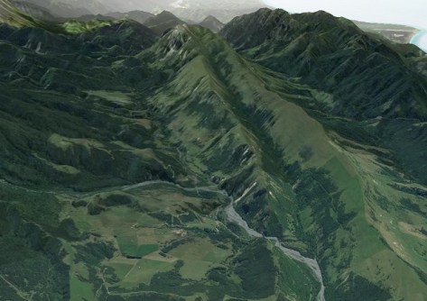
Geospatial professionals and the general public are now able to view large swathes of New Zealand in 3D following upgrades to Toitū Te Whenua Land Information New Zealand’s (LINZ) country-wide Basemaps, which use the latest publicly available data.
According to LINZ Head of Location Information, Aaron Jordan, the 3D Basemaps provide a new way of understanding landscapes across New Zealand through easy-to-view and detailed contours, hill shades and slopes.
“The new feature means everyone can view New Zealand in 3D, helping provide a more in-depth perspective of how our lands are shaped from the mountains to the sea,” he said.
“We’re one of the few countries in the world where this type of service and the underlying data is available at no cost to users.”
Jordan says that having easily accessible, high-quality mapping information helps everyone from homebuilders to farmers and city planners, make informed decisions regarding land use.
According to LINZ, the underlying elevation and imagery data available from the LINZ Data Service is of benefit to a range of users, including councils and regional industries for planning purposes and will help with land and resource management, flood and landslide hazard mapping and emergency response.
“It also helps connect people with parts of the country that are difficult to access…” he said.
The 3D function was formed through overlaying high-resolution images over elevation data.
“People are now able to zoom right down to 1 metre resolution in most areas,” said Jordan.
A substantial amount of the precise elevation data has been collected over the past five years through funding from the Provincial Growth Fund LiDAR Programme, which was managed by LINZ and co-funded by councils and Kānoa, the Regional Economic Development and Investment Unit within the Ministry of Business, Innovation and Employment.


