

Fully digitised cadastral survey data model and exchange have come a step closer to reality.
Boost for humanitarian drone deliveries
By Charles Pauka on 22 February, 2021Wingcopter has joined Flying Labs Network to support locally led drone delivery projects around the world.
Drone specialist expands agri-tech operations into Zambia
By Charles Pauka on 16 February, 2021Delta Drone will expand its reach and use its advanced data capabilities to virtually visualise and analyse crops in Zambia.
Bushfire prediction technology to bolster emergency response efforts
By Charles Pauka on 16 February, 2021The CSIRO and AFAC are to develop a nationally consistent bushfire modelling and prediction capability.
Forest measuring satellite taking shape
By Charles Pauka on 16 February, 2021Biomass, ESA’s forest measuring satellite is expected to deliver exceptional insights only possible from space.
Fixed-wing mapping drone for agriculture
By Charles Pauka on 16 February, 2021The eBee Ag is designed to help farmers, agronomists and service providers capture aerial data and plant health insights.
Microsatellite sends multispectral image 16 days after launch
By Charles Pauka on 16 February, 2021Slovenia has released a colour image from the NEMO-HD microsatellite built by SFL in collaboration with SPACE-SI.
Precision Hydrographic Services wins second tender under HIPP
By Spatial Source on 11 February, 2021PHS has successfully tendered to conduct a bathymetric survey between Cape Jervis and Kangaroo Island.
Latest Geospatial News
View all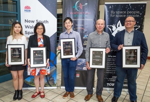
SpiralBlue will be launched into orbit as one of five experiments aboard the ‘Waratah Seed’ CubeSat mission.
 2022-01-13
ADVERTISEMENT

Six innovators will share in $150,000 to deliver outcomes from location data in the land admin sector.
2022-01-12 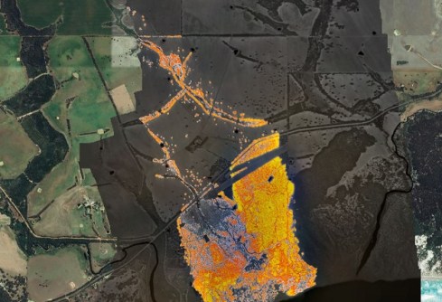
The system takes less than a minute to fly over the fire front and deliver a fire map to the relevant agencies.
2022-01-12 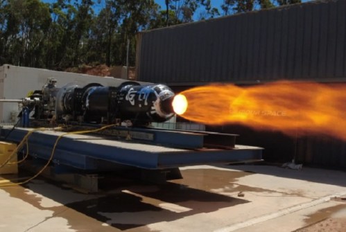
Gilmour Space Tech has conducted a successful 75-second test firing of the engine that will power its Eris rocket.
2022-01-12 
Responses to a Curtin University survey indicate a vital need to tackle GIS accreditation and legitimacy issues.
2022-01-12 
In our Leaders Forum, we asked the experts to look ahead into 2022. Today we talk technology with Robert Kennedy.
2022-01-12
ADVERTISEMENT

In our Leaders Forum, we asked the experts to look ahead into 2022. Today we talk imaging with Tom Celinski.
2022-01-12 
- Sponsored Content
Aidedo was founded based on the practical experience of CEO Aiden Tong while studying and working with many Civil Engineering and Land Surveying firms in developed countries.
2026-06-02
Geospatial information capture, storage and analysis is vital in the ongoing battle against invasive red fire ants.
2022-01-07 



Events
View All-
Nov 9
2026 Advancing Earth Observation Forum
 Hobart, Tasmania
-
Nov 10
SouthPAN Industry Day
Online -
Nov 13
South West and Great Southern Surveyors Conference
Mantra Bunbury Lighthouse, Bunbury, WA -
Nov 24
Locate26 Conference / 10th Digital Earth Summit
Melbourne Convention & Exhibition Centre -
Nov 30

