One Billion Years of Continental Drift
 The Map Room
So this animation went viral last week, showing the movement of Earth’s tectonic plates over the past billion years, posted by one of the co-authors of a study proposing a new, single model of plate tectonic activity that covers the past billion years of Earth’s existence.
 Maps Mania
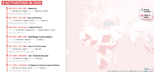
The Humanitarian OpenStreetMap Team (HOT) is a body which liaises between the OpenStreetMap organization and humanitarian organisations. The team is often actively involved in mapping post-disaster areas and in building better risk models for locations around the world.
Map shows all the walking routes that connect Britain’s towns, cities
 Geoawesomeness
This time last year, geographer and explorer Dan Raven-Ellison called out for 100 volunteers to join him for a hack day at the Geovation Hub in London and create a network of 1,000 walking routes that connect Great Britain’s towns and cities. After COVID-19 hit, sending the nation under a lockdown, the former geography teacher and Ordnance Survey Get Outside Champion soon realised that rather than being done in person as part of a hack day, the Slow Ways project could instead be completed online as a citizen geography endeavor.
Shifting Place Names in Africa
 Map of the week
This map from PisseGuri82 shows place names that are no longer in the same location as the current country.
 Maps Mania
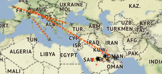
Airplane tracking maps like Flightradar24 and FlightAware are a fantastic resource for tracking flights around the world in real-time. However both Flightradar24 and FlightAware don’t track all planes. At the request of governments, individuals and corporations some aircraft (often considered sensitive) are not shown on these live tracking maps. A significant percentage of those planes whose flight data is censored are aircraft registered by dictators and authoritarian regimes.
Stay up to date by getting stories like this delivered to your mailbox.
Sign up to receive our free weekly Spatial Source newsletter.


