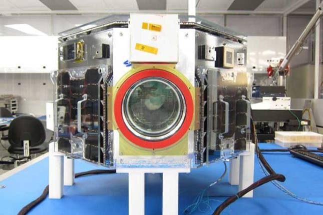
Integrated NEMO-HD Satellite in SFL Clean Room. Photo: University of Toronto Institute for Aerospace Studies.
Slovenia has released a colour image from NEMO-HD microsatellite built by Space Flight Laboratory (SFL) in collaboration with SPACE-SI.
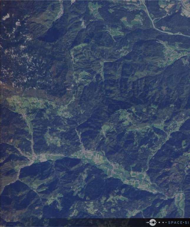
The Slovenian Centre of Excellence for Space Sciences and Technologies (Space-SI) has released the first multispectral image captured by its NEMO-HD Earth observation microsatellite just 16 days after launch. Built by Space Flight Laboratory (SFL) in collaboration with SPACE-SI, NEMO-HD is Slovenia’s first microsatellite carrying a multispectral high-definition Earth observation instrument.
“SFL congratulates Slovenia on this auspicious first step toward building a robust national space program,” said SFL director Dr Robert E. Zee. “NEMO-HD represents a breakthrough in next-generation compact microsatellite missions, and pushes the envelope of what can be accomplished by a small microsatellite in Earth observation.”

Multispectral image captured over Slovenia during the commissioning phase of NEMO-HD, which was launched on 2 September 2020.
“NEMO-HD is enabling a new Earth observation concept by combining multispectral and video imaging from space. This can be controlled interactively in real time if needed when NEMO-HD is flying in the range of a ground station,” said CEO of SPACE-SI Prof. Tomaž Rodič. “With NEMO-HD successfully in orbit, we have achieved a very innovative and cost-effective remote sensing system that combines the agile microsatellite with our transportable ground station system, STREAM, and the advanced EO data processing chain, STORM.”
The Slovenian satellite was built on SFL’s NAUTILUS microsatellite bus, which is an augmentation of SFL’s NEMO bus that has been used for numerous successful microspace missions. With a mass of only 65 kg and dimensions of 60x60x30 centimeters, NEMO-HD captures multispectral (RGB/NIR) images that can be sharpened by a panchromatic channel to 2.8-metre resolution.
The satellite also collects high-definition video at 25 frames per second. The main instrument can be operated in real-time imaging mode, allowing an operator at mission control on the ground to view the video feed as it is captured. If an event or feature of interest is spotted, a command can be sent to the satellite to collect a still image of the area.
Imagery and video data acquired by NEMO-HD will be used to monitor agriculture, forestry, urban development and marine transport, according to Space-SI. NEMO-HD acquired its first historic multispectral image over Eastern Slovenia on 18 September 2020.
“SFL’s ability to develop compact spacecraft with space-proven attitude control and precise pointing technologies at relatively low cost was a major factor in delivering a successful NEMO-HD satellite,” said Zee. “These are critical technical requirements for successful collection of high-quality Earth observation data with microspace platforms.”

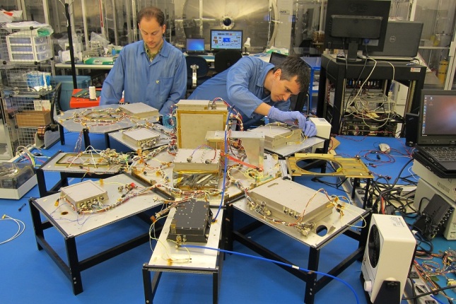
NEMO-HD satellite assembly.
SFL has established itself as a unique microspace provider that offers a complete suite of nano-, micro- and small satellites – including high-performance, low-cost CubeSats – that satisfy the needs of a broad range of mission types from 3 to 500 kilograms. Dating from 1998, SFL’s heritage of on-orbit successes includes 65 distinct missions related to Earth observation, atmospheric monitoring, ship tracking, communication, radio frequency (RF) geolocation, technology demonstration, space astronomy, solar physics, space plasma, and other scientific research.
In its 23-year history, SFL has developed CubeSats, nanosatellites, and microsatellites that have achieved more than 135 cumulative years of operation in orbit. These microspace missions have included SFL’s trusted attitude control and, in some cases, formation-flying capabilities. Other core SFL-developed components include modular (scalable) power systems, onboard radios, flight computers, and control software.
Stay up to date by getting stories like this delivered to your mailbox.
Sign up to receive our free weekly Spatial Source newsletter.


