

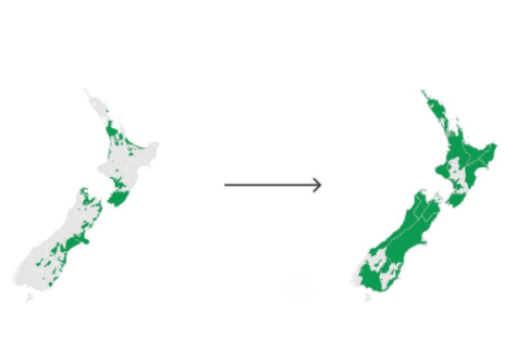
New Zealand’s National Elevation Programme has passed the 50% coverage mark, following the release of 3D LiDAR mapping data for the Waikato and Southland regions.
The LiDAR information is combined with other data to produce precise, 3D digital elevation models, which can be freely accessed via the Toitū Te Whenua LINZ Data Service.
In 2016, Toitū Te Whenua LINZ in partnership with Regional Councils began the project to procure and make available a nationally consistent baseline elevation data set for Aotearoa New Zealand. By 2024, 80% of the country will be covered and the data will be available on open licence.
The project will provide three data sets once the aerial LiDAR capture is complete:
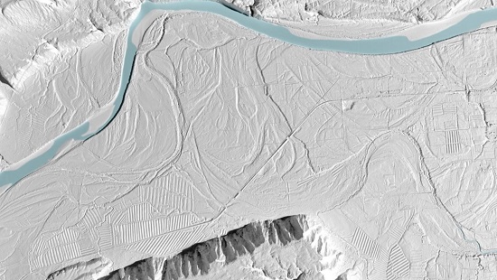
- 1-metre digital elevation model (DEM) — a model of the bare earth.
- 1-metre digital surface model (DSM), which includes non-ground features such as buildings and infrastructure
- A point cloud, with data points classified into sets of likely feature types, such as water features, vegetation groups and buildings.
“There is great demand for the data by local government, private sector companies, academia and Crown Research Institutes, and this demand continues to grow as the national coverage expands,” says Bjorn Johns, Toitū Te Whenua Technical Leader Imagery and Elevation.
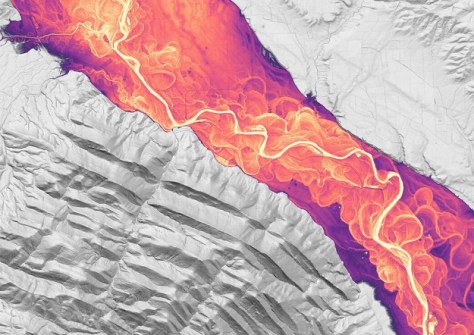
“These are invaluable to councils and regional industries for planning and will help with land management, flood and landslide hazard mapping, engineering design and 3D visualisation.”
“Having baseline data will make it easier to assess changes resulting from major events like earthquakes and severe weather events,” Johns added.
“Areas can be resurveyed and the new images compared with base data to better understand the impact of the events and to support the response and recovery phases of an emergency.”
The release of the Waikato and Southland data adds to that already collected and released through a project co-funded by regional councils and Kānoa, the Regional Development and Investment Unit within the Ministry of Business, Innovation and Employment (formerly the Provincial Growth Fund).
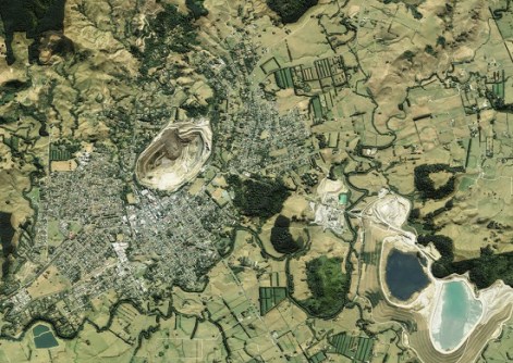
“Having early access to data covering parts of the country at this level of detail is fascinating as we see the many different types of landforms and relief features that are ‘unearthed’ by elevation data,” said Location Data Analyst Emory Beck, who is working on quality control of the new data.
According to Toitū Te Whenua Manager Partnership Programmes, Andrew Ferrel, there is a real sense of satisfaction, not just in reaching the 50% milestone but in seeing how the data is being used.
“Making this data available supports innovation and gives all businesses and other operators access to detailed information that would otherwise be unavailable to many.”
Co-funding from Kānoa–RDU is supporting the substantial regional expansion of the New Zealand National Elevation Programme, which is based on partnerships between Toitū Te Whenua and councils across all 16 New Zealand regions.


