Update: This event has been rescheduled from its original date of 24 February.
The SSSI 2021 Victorian Surveying & Spatial Summit will be an opportunity for all Victorian surveying and spatial professionals to come together to learn, share and connect. The theme will be ‘Digital Transformation: Our Future’.
The one-day event will take place at the Novotel on Collins, Melbourne, and will be followed in the evening by the presentation of the Victorian Asia-Pacific Spatial Excellence Awards — the Awards celebrate the outstanding work being undertaken by individuals and organisations in the region.
Discounts are available for SSSI members and students. You can choose to register just for the Summit or select full registration which includes a ticket to APSEA-V event as well. Tickets for APSEA-V only (individual or full table of 8) are also available.
There will also be a pre-summit breakfast on the topic of Diversity and Inclusion, and organisers encourage potential participants to consider purchasing a ticket when registering for the Summit.

The ROTORTECH 2022 Helicopter and Unmanned Flight Exposition is the premier industry event for the Helicopter/Rotary Wing and RPAS/UAV/eVTOL community in Australia, New Zealand and the Indo-Asia-Pacific region.
The event provides a vital interface between industry, regulators and government, including:
- Operations and safety presentations
- Industry conferences
- Industry exposition showcasing the products and services of helicopter and unmanned flight related companies
ROTORTECH 2022 will host conferences by the Australian Helicopter Industry Association (AHIA) and Australian Association for Uncrewed Systems (AAUS) and feature presentations by key rotary and unmanned systems industry experts from Australia and the Indo-Asia-Pacific region.

The Space & Geospatial Collaborative Workshop is being jointly hosted by the Andy Thomas Space Foundation and SSSI in Adelaide on 10 May 2023, in between the first 2023 Australian Space Forum and the Locate23 Conference.
This inter-disciplinary workshop will provide an opportunity for professionals from both space and spatial sectors to connect and discuss the increasing synergy and collaborative opportunities that have resulted from Australia’s renewed commitment to space technology development and the requirements and capabilities of the modern spatial information industry. The spatial professional has been an enduring end-user of space applications such as PNT (positioning, navigation and timing), EO (Earth observation) and telecommunications.

SmartSat partners, participants, students and staff are invited to come together to share their research outcomes and network with industry colleagues at the SmartSat CRC Conference 2023.
The SmartSat CRC is a consortium of universities and other research organisations, partnered with industry that has been funded by the Australian Government to develop know-how and technologies in advanced telecommunications and IoT connectivity, intelligent satellite systems and Earth observation next generation data services.
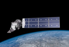
Landsat image courtesy NASA/GSFC


