

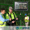
Infrastructure software company Bentley Systems has announced the winners of the 2012 Be Inspired Awards. The company says “the awards honour the extraordinary work of Bentley users improving the world’s infrastructure” and were presented at a ceremony during the annual Be Inspired: Innovations in Infrastructure event, held in Amsterdam, Netherlands. Five independent panels of jurors, […]
Search results for "be inspired"

2012 Bentley Be Inspired Awards call for submissions
Bentley Systems Inc. recently announced that it is accepting submissions for the 2012 Be Inspired Awards global competition. The deadline for entries is August 3, 2012. The Be Inspired Awards is held in conjunction with the Be Inspired: Thought Leadership in Infrastructure event in Amsterdam, the Netherlands, held November 13-14, 2012. Providing a […]

Bentley calls for global infrastructure excellence
The Be Inspired Awards will be held at the Year in Infrastructure 2017 Conference in Singapore, a city renowned for BIM advancements.

Celebrating women in the spatial, space sectors
On International Women’s Day, we profile four professionals who have forged very different career paths.
Advancing GNSS, Geoscience and Water Infrastructure
The use of high-accuracy GNSS technology is now a central focus among water and wastewater service providers to enhance their overall operations and profitability.

Micromobility Conference 2022
When:
25 November, 2022 @ 9:00 am – 26 November, 2022 @ 4:00 pm
Where:
Royal Randwick Racecourse, Sydney, Australia
ustralia’s first dedicated Micromobility Conference and Expo will give delegates the opportunity to learn about best practices from international and Australian experts. After hearing from inspirational keynote speakers, the Micromobility Conference will break into delegates’[…]

12d Tech Forum 2021 | Online Industry Summit
Hosted by 12d – the companies behind 12d Model and 12d Synergy – the highly anticipated 12d Tech Forum returns on 19 – 21 October 2021. The three-day online industry summit will connect over 2,000 surveying, engineering, and construction professionals to learn, innovate, and be inspired. The 12d Tech Forum provides surveying and geospatial professionals […]
Read full story • Comments are closed
Ordnance Survey launches OS Maps for Australia
Ordnance Survey is taking Britain’s outdoor mapping app onto Australian terrain.
12d Tech Forum 2021 | Online Industry Summit
When:
19 October, 2021 – 21 October, 2021 all-day
Where:
Virtual Event
Hosted by 12d – the companies behind 12d Model and 12d Synergy – the highly anticipated 12d Tech Forum returns on 19 – 21 October 2021. The three-day online industry summit will connect over 2,000[…]
Postponed – International Lidar Mapping Forum
When:
23 March, 2020 – 25 March, 2020 all-day
Where:
Walter E. Washington Convention Center, 801 Mt Vernon Pl NW, Washington, DC 20001, United States
Why Attend? International Lidar Mapping Forum (ILMF) is a technical conference and exhibition showcasing the latest airborne, terrestrial, and underwater lidar as well as emerging remote-sensing and data collection tools and technologies. With a special emphasis on[…]


