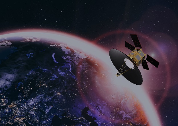
Artist’s impression of the TeLEOS-2 polarimetric synthetic aperture radar satellite. Courtesy ST Engineering.
ST Engineering’s first polarimetric synthetic aperture radar (PolSAR) satellite, TeLEOS-2, was launched on 22 April 2023 from the Satish Dhawan Space Centre SHAR, Sriharikota, India.
Developed in partnership with Singapore’s Defence Science and Technology Agency (on behalf of Government of Singapore), the 750kg TeLEOS-2 features a made-in-Singapore SAR payload and is able to capture both day and night images under all-weather conditions at high resolution, with full polarimetry.
Operating in near-equatorial orbit at 10 degrees inclination, the satellite will provide 1m imagery with an average of 14 passes a day.
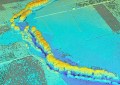
Applications for its data include disaster monitoring and management, environmental monitoring, natural resource exploration and management, climate change and weather studies.
“The development and launch of TeLEOS-2 represent another milestone in our journey in building up indigenous capabilities for the expansion and commercialisation of our satellite technologies,” said Low Jin Phang, President, Digital Systems, ST Engineering.
The previous week, King Abdullah University of Science and Technology (KAUST) launched a Cubesat satellite with its partner Spire Global on the SpaceX Transporter-7 mission from the Vandenberg Space Force Base in the US.
The satellite aims to collect high-quality and high-resolution data across global terrestrial, coastal and ocean ecosystems to help Saudi Arabia observe and characterise its unique natural resources.
The 6U satellite hosts a hyperspectral camera with advanced on-board processing capabilities in combination with Spire’s Global Navigation Satellite System-Reflectometry (GNSS-R) sensor payload, and will collect insights on Earth surface features such as the condition of plants, soils and water.
“We’re lauching state-of-the-art technology on this satellite platform,” said Matthew McCabe, professor of remote sensing and water security, and director of the Climate and Livability Initiative at KAUST.
“The hyperspectral imager is not only collecting imagery, it also integrates with onboard processing that allows analysis of the data even before it is returned to the ground.
“The combination of this capability with two unique sensors — the GNSSR and the hyperspectral — offers one of the first in-orbit demonstrations of such technologies. It’s the mix of cutting-edge imaging and on-board analysis that makes this such an exciting mission.”