


Craig Sandy, Surveyor-General of Victoria
It’s going to be a busy year for the Surveyor-General of Victoria and his expert team.
By Jonathan Nally
Craig Sandy LS GAICD is the Surveyor-General of Victoria and the primary government authority on surveying and the cadastre; his role includes being the Chair of the Surveyors Registration Board of Victoria (SRBV). He is also the chair of the Intergovernmental Committee on Surveying Mapping (ICSM).
What is the focus for Surveyor-General Victoria in 2023?
In 2023, Surveyor-General Victoria (SGV) will focus on innovation to provide better service for all Victorians. We will use digital systems to modernise our processes and platforms to drive opportunities for improvement. Our work to transform the cadastral system and embrace digital data will ensure we continue to provide accurate information and advice to our stakeholders. SGV is also focused on preparing for the future by building a thriving culture that attracts and retains a capable, diverse, and inclusive workforce.
What’s the status of Victoria’s cadastre system?
Land Use Victoria (LUV), through consultation with the surveying profession and the geospatial sector, has developed a 10-year strategy and vision for the modernisation of Victoria’s cadastre. The strategy is due for release early in 2023 and has three pillars that will guide development over the next decade:
- Three dimensional (3D) and digital cadastral data
- Streamlining the cadastral data lifecycle, and
- Nationally agreed standards and protocols.
In 2023, LUV will continue to engage and work with the surveying profession to understand the pathway and barriers to digital lodgement for all cadastral survey data. This engagement began in January.
The Victorian Government will continue to be a project partner with the ICSM in the development of the 3D Cadastral Survey Data Model (3D CSDM). This is a collaborative project to develop a data model for the management of cadastral data in the third dimension and incorporating the fourth dimension (time). In 2022, the conceptual model was developed and in 2023 the next phase of the project will commence with the aim to develop a data exchange format. New Zealand, New South Wales, Queensland and Western Australia have been working to ensure the development of a nationally and internationally relevant format now and in the future.
What’s on the horizon for surveying licensing in Victoria?
In December 2022, SRBV released the recommendations for the review of the process for licensing surveyors in Victoria and has recently released a draft model for a new licensing pathway. The new pathway incorporates the work of the Council of Reciprocating Surveyors Boards of Australia and New Zealand (CRSBANZ) on a National Competency Standard for graduates and licensed/registered surveyors. The draft model is available for review and comment. The next step will be to create the new pathway together with interested organisations and individuals. An expression of interest will be available for the development of the model.
Discussions with CRSBANZ, the other Australian and New Zealand Surveyors Boards, academic institutions and industry organisations will help to refine the draft model and to progress its implementation.
Is Victoria getting heavily involved in SouthPAN?
Australia and New Zealand released its first Satellite Based Augmentation System (SBAS) in late 2022. SouthPAN offers 10cm level accurate real-time positioning when access to mobile, internet and radio telecommunications and use of the existing Continuously Operating Reference Station (CORS) network is unavailable. Victoria is preparing to support the delivery of the SBAS service.
What’s the status of Victoria’s $45 million investment in digital cadastre?
The five-year Digital Cadastre Modernisation (DCM) program is scheduled to conclude in 2023. Victoria will have a spatially accurate digital representation of the cadastre, with eleven Local Government Areas already released into our VicMap products. The benefits of this investment will be realised as users begin to change their processes to incorporate the new data in their work.
Land surveyors will benefit from the update through the Vicmap Survey product in terms of:
- Reduced manual entry of survey data, and
- Improvements to the data set for future users.
Surveyors can download accurate cadastral data prior to beginning their survey work and it can be used as part of the pre-field assessment. Any differences identified by the surveyor can be provided to LUV to update the cadastre and continually improve the accuracy for future users. Land Use Victoria is also modifying our internal processes to incorporate the new data sets into project survey work in SGV and create automated processes to include the cadastre in Digital Twin Victoria platform.
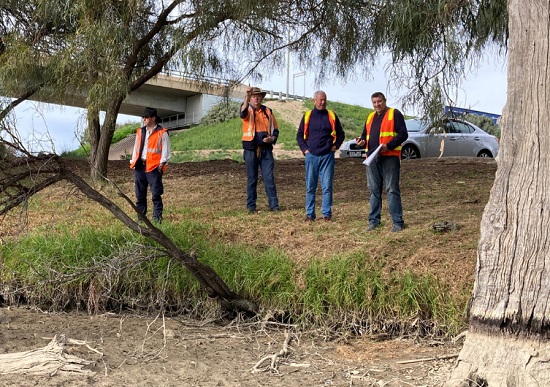
Craig Sandy (far right) and other members of the SGV conducting survey work on the banks of the Murray River. Photos courtesy SGV.
Does the SGV get involved in promotion of the profession?
The Victorian Survey Taskforce (STF) is working with SGV to promote the surveying profession to school children and will distribute the material produced by SheMaps and Get Kids into Survey to promote careers in surveying at primary and high schools.
SGV will continue to promote diversity in the surveying profession through our ‘Diversity and inclusion in surveying’ university scholarships. In 2022, four students were sponsored to study at RMIT University and the University of Melbourne. Two of our sponsored students graduated in 2022. The university scholarship program will continue in 2023 and is available for women and Indigenous students and provides financial support for students studying geospatial science and surveying disciplines. SGV also invites current students to undertake summer work experience at SGV to learn more about the diverse roles in our team and apply some of their learnings.
What about technological change in surveying?
Over the last two years, our team has been utilising laser scanner and drone technology for application in our work. Part of this work is assessing the potential for use in cadastral surveying and identifying the most appropriate methods for calibration, to enable legal traceability of observations and measurements to comply with the National Measurement Act 1960.
While technology is a driver for training and upskilling staff, there are other aspects to training that will be a focus throughout 2023. LUV employs more than ten graduates eligible for entering or progressing a Professional Training Agreements; improving our training methods is always under consideration.
For those who not already aware, please tell us about the ICSM.
The ICSM works collaboratively with government land organisations from Australian government jurisdictions and New Zealand. Together with ANZLIC – The Spatial Council, we are responsible for the delivery of standards, protocols and practise guidelines and providing a consistent approach to surveying, mapping and charting across Australia and New Zealand.
ICSM supports ANZLIC in the delivery of the ANZLIC Roadmap and provides leadership, co-ordination and standards for assembling, delivering and maintaining national framework geospatial datasets.
What is the focus for ICSM in 2023?
The Australia Geospatial Reference System Compendium, Addressing 2035, Phase 1 of 3D Cadastral Survey Data Model and the standard for the accuracy of spatial cadastres publications have been delivered. Our work for 2023 will focus on the modernising of foundational spatial data, including the standards to support these data sets.
2023 is an exciting time for the ICSM team as it focuses on several key activities:
- Review of the current ICSM strategic framework and action plan, along with the development of a new Terms of Reference and Governance Charter that will be released to reflect changes to ICSM in recent years. This will include expanding the Foundation Spatial Data Framework to incorporate four additional themes from the Global Fundamental Geospatial Data Themes.
- Development and implementation of an Addressing Plan for 2023. This plan will modernise the way street addresses are assigned and used in a modern community. The 2-dimensional addresses aligned to the centroid of a land parcel are no longer sufficient to support the range of applications our community require to access services and ensure public safety.
- Release of an ‘Imagery statement of direction’. This statement will complement the existing Elevation and Depth 2034 strategy. With LIDAR and a range of satellite platforms providing a wide choice in the use of imagery, this statement will support all governments with standardised imagery to provide economic value in solving the most pressing environmental challenges. I’m looking forward to the release of this strategy in 2023.
- Establish a working group to focus on the work around data standards in the marine environment. This group will be focused on the S100 standard for Australia and New Zealand. The S100 standard is for the mapping of marine assets. The standard has subclasses for defining the type of assets to be mapped; for example, navigation aids and port features. This aim is to develop digital products and services for operators in hydrographic, marine and GIS communities. It is an important piece of work for countries surrounded by ocean.
On a personal note, what your thoughts for the year ahead?
From a personal perspective, 2023 is shaping to be a year of opportunity — a time to make connections through government, academia and industry and to find creative solutions in partnership to some of our biggest challenges. Our profession needs to work more closely together to resolve these challenges.
Technology is an enabler for greater insights and working more efficiently, but developing the people in our profession is equally important. Machine learning and AI solutions only provide value when highly skilled and trained professionals can assess outcomes to ensure high-quality results are achieved. This will be a year to focus on developing our people and their capability in working in a highly digital environment.


