

Awards were given for work ranging from AI in mapping to educating the next generation of surveyors.
Are Larger Format Cameras Better for Mapping?
By SS Advertiser on 1 September, 2024Larger format cameras capture a larger footprint per image, and fewer images can certainly speed up the mapping process both in terms of acquisition and processing time. But does this make them better for mapping? Other factors that play a role in choosing cameras include camera body material, lens quality, resolution, file size, and format. […]
Workshop Topic – 4 Tips to Success When Mapping with Drones
By SS Advertiser on 29 August, 2024Hosted by Eric Andelin CP, Senior Workflow Advisor, SimActive with guest speaker Gordon Morris, Owner of GMAPSNZ
Maxar’s second WorldView Legion duo launched
By jnally on 28 August, 2024Maxar’s third and fourth WorldView Legion Earth observation satellites are now being commissioned in orbit.
Four-year LiDAR mapping project completed
By jnally on 27 August, 2024New Zealand’s Southland region is now LiDAR-mapped to 8m resolution in rural zones and 20cm in some urban areas.
Geospatial data helping Māori reconnect
By jnally on 26 August, 2024A new app is being used to help Māori reconnect with their whenua (land) and whakapapa (family tree).
Latest Geospatial News
View all
The Program will including hands-on collaboration and the ability to trial advanced digital twin technology.
 2025-01-22
ADVERTISEMENT

In our annual Leaders Forum, we ask the experts to look ahead into 2025. Today we talk surveying with Travis Gains.
2025-01-22 
Data visualisation and mapping have a vital role in preparing for and responding to hazards and disasters.
2025-01-21 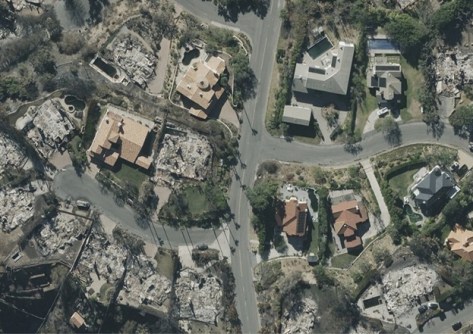
Vexcel will offer its aerial imagery, geospatial data and property attributes services, including post-disaster images.
2025-01-20 
In our annual Leaders Forum, we ask the experts to look ahead into 2025. Today we talk workforce with Samantha Garbutt.
2025-01-20 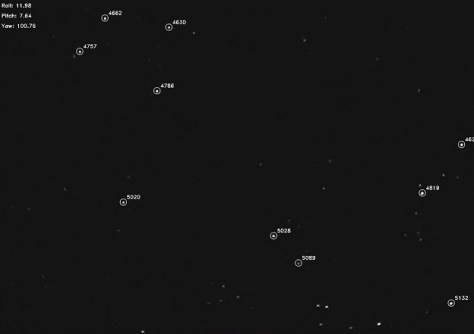
Australian researchers have developed a navigation system that uses visual data from stars rather than GNSS.
2025-01-15
ADVERTISEMENT

Digital Twin Victoria is seeking input from the geospatial sector to ensure the platform is meeting user needs.
2025-01-15 
- Sponsored Content
Aidedo was founded based on the practical experience of CEO Aiden Tong while studying and working with many Civil Engineering and Land Surveying firms in developed countries.
2026-06-02
In our annual Leaders Forum, we ask the experts to look ahead into 2025. Today we talk intelligence with Allison Patrick.
2025-01-15 



Events
View All-
Nov 9
2026 Advancing Earth Observation Forum
 Hobart, Tasmania
-
Nov 10
SouthPAN Industry Day
Online -
Nov 13
South West and Great Southern Surveyors Conference
Mantra Bunbury Lighthouse, Bunbury, WA -
Nov 24
Locate26 Conference / 10th Digital Earth Summit
Melbourne Convention & Exhibition Centre -
Nov 30

