

An extra $529,000 will help see the Otago Regional Council’s 3D LiDAR program through to completion in 2027–28.
Contract signed for new Sentinel-1 NG satellites
By jnally on 18 June, 2026The next-generation synthetic aperture radar satellites will have improved electronics and observation capabilities.
AEO26 Forum deadlines coming up next week
By jnally on 18 June, 2026June 26 is the abstract and early bird registration deadline for the Advancing Earth Observation Forum in Hobart.
Spatial Snippets for Wednesday, 17 June
By jnally on 17 June, 2026This week: Jobs for spatial analysts and GIS experts, A-SPEC events, S-100 developments and bush fire maps.
GNSS reflectometry for helping farmers with water
By jnally on 16 June, 2026A New Zealand-led effort aims to help deliver more accurate, near real-time insights into soil moisture.
ANZLIC sees shift to decision-making from data
By jnally on 16 June, 2026The peak body says geospatial is increasingly shaping how governments and industry tackle real-world challenges.
Latest Geospatial News
View all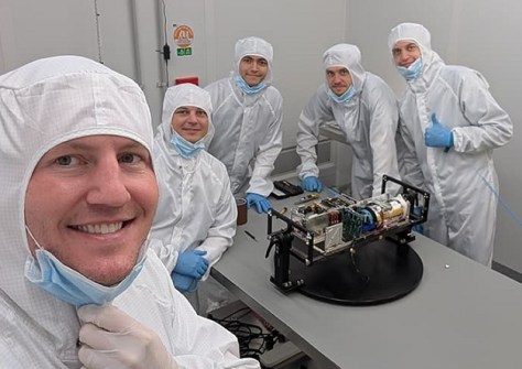
The SWIRSAT infrared satellite is taking shape at Edith Cowan University ahead of its upcoming launch.
 2026-07-14
ADVERTISEMENT
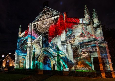
LiDAR scanning of buildings was the backbone of this and previous years’ Vivid festival light projection shows.
2026-07-14 
For the first time, geospatial professionals will be able to accurately identify their job type on the Census form.
2026-07-14 
All your questions about the upcoming combined Locate26 / 10th Digital Earth Summit conference, answered.
2026-07-13 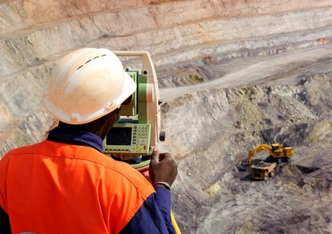
The Surveyors Board of Queensland has issued a reminder about oversight, verification and certification practices.
2026-07-10 
Clara Resources’ 39-square-km aerial LiDAR scanning campaign has identified seven potential exploration targets.
2026-07-09
ADVERTISEMENT
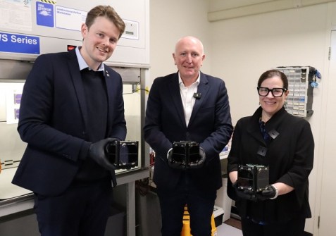
The Western Australia government has committed $2.5m for Curtin’s Binar satellite program and $4m for AROSE.
2026-07-09 
- Sponsored Content
Aidedo was founded based on the practical experience of CEO Aiden Tong while studying and working with many Civil Engineering and Land Surveying firms in developed countries.
2026-06-02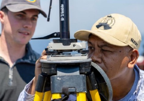
Geospatial specialists from the Royal Australian Navy and the Philippine Navy have joined forces for exercises.
2026-07-09 Cool Tools
View All-
 Responsible AI for better decisions: Why geospatial context matters
-
 Stop parking it: meeting the Essential Eight with ArcGIS may be more achievable than you think
-
 GBM Konect launches Konect 2 to close the field data gap
-
 Inside the 12d Tech Forum 2026: Automation, Collaboration, and the Industry’s Next Chapter
Events
View All-
Oct 30
Tasmanian Surveying & Geospatial Conference 2026
 Country Club, 100 Country Club Avenue, Prospect Vale (Launceston)
-
Oct 30
Western Australia EISSI Awards 2026
Pan Pacific, Perth -
Nov 6
GIS in Local Government Day 2026
Amora Hotel Adelaide, 233 Victoria Square, Adelaide -
Nov 9
2026 Advancing Earth Observation Forum
Hobart, Tasmania -
Nov 10
SouthPAN Industry Day
Online

