The contract will see Woolpert collect topographic and bathymetric LiDAR data and aerial imagery across the islands.
Geoscience Australia to give online update briefing
The Showcase 2026 event will cover the Digital Atlas of Australia, seabed mapping, critical minerals and more.
Read moreLatest Geospatial News
View all
ADVERTISEMENT
The firm’s new presence at Australian Space Park will enable the production of satellites of up to 300 kg.
Defence portfolio agencies could procure goods and services valued between $8m to $20m over five years.
S-5B Hydrographic Surveyor and S-8B Nautical Cartographers training program returns for 2022.
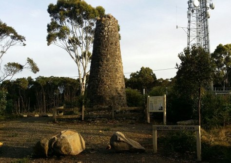
The 8m-high, mortared stone survey cairn was built in 1860 as part of the original Geodetic Survey of Victoria.
Dr Zaffar Sadiq Mohamed-Ghouse will bring his extensive experience to the EO organisation’s leadership.
ADVERTISEMENT
Esri will enhance its ArcGIS Living Atlas World Imagery layer with higher-resolution Maxar Vivid basemaps.
Aidedo was founded based on the practical experience of CEO Aiden Tong while studying and working with many Civil Engineering and Land Surveying firms in developed countries.
The Forum aims to foster open standards collaboration between standards bodies, industry and academia.
Events
View All-
Nov 24
Locate26 Conference / 10th Digital Earth Summit
Melbourne Convention & Exhibition Centre -
Nov 30
-
Feb 5
2026 National EISSI Awards
The Marion, Barrine Drive Regatta Point, Commonwealth Park, Canberra -
Mar 15
Association of Public Authority Surveyors, NSW, 2027 Conference
Crowne Plaza, Terrigal