

Researchers have joined forces in an attempt to find and map the locations of shipwrecks in Tasmanian waters.
Although almost 1,000 ships are known to have gone to their graves off the Tasmanian coast, only about 9% of them have known locations.
Responsibility for managing shipwrecks and downed aircraft sites in Tasmanian waters has been vested with the Tasmania Parks and Wildlife Service (PWS), on behalf of the Australian Government.
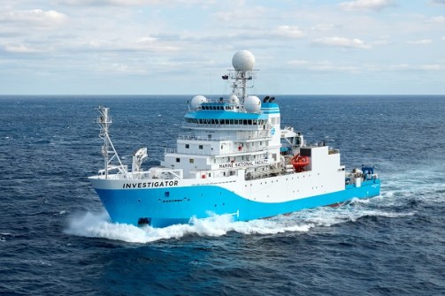
In November last year, PWS Historic Heritage Manager Annita Waghorn joined an underwater survey voyage on CSIRO research vessel (RV) Investigator, to survey shipwrecks along the Australian mainland’s east coast as well as Tasmania’s coast.
Another major goal of the voyage was to explore two underwater Indigenous cultural landscapes in NSW waters.
Two out of ten
The voyage brought together researchers and heritage experts from the CSIRO; the federal Department of Climate Change, Energy, the Environment and Water; the Australian National Maritime Museum; the University of Adelaide; Elders and Traditional Owners of Sea Country; and agencies from Tasmania, New South Wales and South Australia.
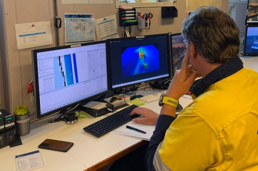
In partnership with CSIRO mapping experts and technicians, the team used multibeam sonar to map the seafloor and investigate the condition and location of historic wrecks and map the underwater Indigenous cultural landscapes.
Surveys were made of ten locations where Tasmanian shipwrecks were thought to be, but wrecks were found at only two of them.
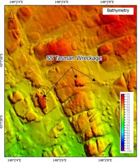
The team also surveyed the wreck of the SS Tasman off the Hippolyte Rocks on the Tasman Peninsula. Maps and models of the wreck had previously been made by the private divers who first located and identified it, but this was the first time the site had been mapped using high-resolution sonar.
“By bringing together heritage experts, researchers and Traditional Owners, this voyage demonstrated how RV Investigator’s mapping capabilities can support the protection and management of underwater heritage,” said Matt Kimber, Group Leader with the CSIRO Marine National Facility
“The CSIRO team was privileged to help bring these hidden landscapes and shipwrecks into clearer view.”
Data from the voyage will be added to the Australasian Underwater Cultural Heritage Database and also contribute to the international Seabed 2030 program.


