

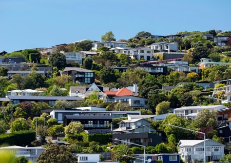
Christchurch lost 14.5% of its urban tree cover over just five years, according to a study that employed GIS, LiDAR and aerial imagery.
The research, conducted by PhD candidate David Pedley and Professor Justin Morgenroth from the University of Christchurch’s School of Forestry, also used AI to work out exactly where the tree cover losses occurred across the city.
The techniques used were precise enough to identify urban tree cover (UTC) changes on individual properties.
The research, ‘Detecting and measuring fine-scale urban tree canopy loss with deep learning and remote sensing,’ has been published in the ISPRS Open Journal of Photogrammetry and Remote Sensing.
The scientists used publicly available remote sensing data, and worked out a way to overcome poor alignment of aerial imagery.
“This research provides a novel geospatial method for evaluating fine-scale city-wide tree dynamics using remote sensing data of varying type and quality with imperfect alignment,” they write in their paper.
“This creates the opportunity for detailed evaluation of the drivers of UTC loss on individual properties to enable better management of existing urban forests.”
Level of precision
The researchers say their results will hopefully lead to healthier, safer and cooler suburbs.
“Urban trees play a critical role in making cities more liveable,” said Pedley.
“They help cool neighbourhoods, improve air quality and support wellbeing, but until now, it’s been difficult to track exactly where and why we’re losing them.”
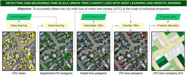
Pedley and Morgenroth mapped tree canopy loss between 2016 and 2021 at a level of detail not previously possible, showing that of the 14.5% of the city’s urban tree canopy loss, most occurred on residential land.
“What’s new here is the level of precision we can achieve with the data,” said Pedley.
“We can now identify tree loss at the scale of individual properties, which creates opportunities to better understand the drivers behind it and respond more effectively.”
Quality of life
Professor Morgenroth says the ability to narrow in on where canopy loss is happening could support better targeted decision-making by local governments, planners and communities.
“If we want to maintain the benefits of urban trees, we need good data to inform our decisions,” he said.
“This kind of insight can help guide planning, policy and investment to protect and grow urban forests where they are needed most.”
Urban trees help to reduce urban heat, manage stormwater and support biodiversity, as well as contributing to quality of life.
“This isn’t just about measuring loss — it’s about giving cities the tools to make better decisions for the future,” said Pedley.
See also:


