In partnership with the Australian Space Agency, the Space Industry Association of Australia will host the Southern Space Symposium at the National Press Club in Canberra on 29-30 November 2021.
The Southern Space Symposium is the Australian space industry’s flagship annual conference, bringing together space industry experts and decision-makers from across Australia. At a pivotal moment, the Southern Space Symposium will this year bring space industry together with government and parliament for two days in Canberra to help shape the future agenda for Australian space’s aspirations.
Participants will include federal government departments and agencies, international agencies and missions, defence and space prime contractors, listed space companies, academic and research organisations, small and medium enterprises, space start-ups, and individual space professionals.

On behalf of the Locate Australia Conferences it is our pleasure to invite you to join us at Locate22, 24 – 26 May in Canberra, Australian Capital Territory.
Locate22 returns to the Nation’s Capital in the traditional format of a live event at the National Convention Centre Canberra (NCCC). With the ability to be COVID safe, within a socially distanced environment, the NCCC is the perfect venue for Australia’s premier spatial and surveying conference. Canberra brings an incomparable setting with iconic national attractions surrounding Lake Burley Griffin and the Parliamentary Triangle.
This year Locate22 will incorporate dedicated streams into the format of the conference. This will enable focused discussion from across industry sectors on how location technologies and practices are being used, highlighting the fundamental role they play in shaping Australia’s future.
Industry, government, non-profit and academics are demanding new opportunities for innovation, efficiency and improved responsiveness, particularly in location-based information. In the past year alone, we’ve seen how location information can provide societal, environmental and economic benefits to our communities. Recent national emergencies such as bushfires, drought, floods and COVID-19 all have long-term effects on our cities, towns, land, environment and people. These national, place-based challenges require collaborative solutions that must be data-driven, provide insightful analysis, and be easy for anyone, anywhere to use.
Location in Action is about how we learn, share and connect as a community and with end users to drive deeper insights and aid better decision-making powered through location data, science and technologies.
Come and join us in Canberra where you will have an opportunity to network with national and international colleagues, have direct access to industry and subject matter experts, see the newest technology, and be introduced to the newest ideas in the spatial and surveying sector.
ALISON ROSE
CONVENOR
LOCATE 22

The International Society for Photogrammetry and Remote Sensing (ISPRS) will hold its 2022 congress in Nice, France, in June 2022. The event will be hosted by the French Society for Photogrammetry and Remote Sensing.
A wide-ranging program has been put together, and it includes a host of leading speakers, such as Australia’s Professor Sisi Zlatanova from the University of South Wales. More than 1500 papers will be presented in the various scientific tracks and sessions over the week. In addition to these presentations, participants will also have the chance to interact and network face-to-face with the authors in poster sessions.
In order to help the registered participants to choose the sessions and the presentations to build their own program during the week, pre-recorded video presentations of the papers will made accessible before the beginning of the event through the digital platform of this event.
The Congress will have a strong technology track, with a large exhibition space that will gather the major players of the geospatial business. A geospatial prospective forum will also address hot topics of our community in order to draw recommendations.
The deadline for both full papers and abstracts is January 10, 2022.

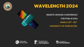
The Wavelength meeting was launched in 2013 for PhD students and early career researchers, addressing the demand for representation of new professionals as well as students from RSPSoc — the UK society for remote sensing and photogrammetry science.
Every year, Wavelength gathers participants from student and early career levels, as well as senior members and individuals within academia and business. The conference offers a setting to present student and EC work and meet new, like-minded contacts.
The 2024 conference will be run in a hybrid format, to accommodate those who can and those who cannot travel to Worcester.


