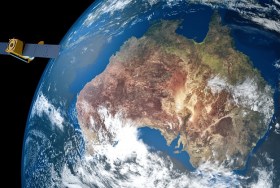
The Space & Geospatial Collaborative Workshop will be jointly hosted by the Andy Thomas Space Foundation and the Surveying and Spatial Sciences Institute in Adelaide the day following the 12th Australian Space Forum and the day before Spatial Information Day.
This inter-disciplinary workshop will provide a unique opportunity for professionals from both space and spatial sectors to:
- Learn about Australia’s renewed commitment to space technology development
- Get updates on the requirements and capabilities of the modern spatial information industry using applications such as PNT (positioning, navigation and timing), EO (Earth Observation) and telecommunications
- Connect and discuss the increasing synergy and collaborative opportunities between the two sectors.
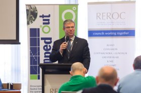
The latest in spatial data applications will be showcased at this year’s Mapped Out Conference to be held at the Rules Club in Wagga Wagga on Wednesday 2 & Thursday 3 March 2022.
Mapped Out will highlight the diversity of applications for spatial data, geographic information systems and their supporting technologies. Guest speakers with local and national experience will be showcasing the use of spatial data to enhance the operation and delivery of government services.
The Conference is a great opportunity for people working in regional NSW in both local government and the private sector to keep abreast of the latest technology and geographical information systems that can be utilised in their day to day work.
UPDATE, 27 January 2022: Montgomery Asia, the organiser of Geo Connect Asia, has announced new dates for the Show and Conference, which had been scheduled for 23 and 24 March 2022. The event will now be held across 1 and 2 June 2022 at the Marina Bay Sands Expo & Convention Centre, Singapore.
The date change will allow time for local event restrictions and international travel rules to gradually relax and facilitate expanded business and networking opportunities across core Asian markets.
With the rise of Industry 4.0, Geo Connect Asia looks to host their ASEAN neighbours and build on a vibrant geospatial community. The emergence of AI, blockchain, IoT, robotics and UAVs create a new dynamic and platforms for a region well equipped to take on the challenges ahead. Geo Connect Asia is your only gateway to meeting some of the world’s biggest players in geospatial technology and location intelligence solutions, right at the heart of Singapore.
The Geo Connect Asia Conference provides a strategic and collaborative platform for industry professionals, government agencies and start-ups to come together to build and develop knowledge and solutions for Asia’s geospatial & location intelligence markets. It also comprises panel sessions to provide interactive responses to real and current challenges.
Learn from respected key opinion leaders
Geospatial professionals and thought leaders from around the world represent topically relevant areas of the industry in a collaborative and lively platform.
Key Industries
![]()
![]()
![]()
![]()
![]()
![]()
![]()
![]()
![]()
If you are interested in knowing about conference sponsorship opportunities and/or live or virtual meeting spaces at Geo Connect Asia 2022, please contact Rupert.Owen@montgomeryasia.com.

The 15th International Conference on Spatial Information Theory, COSIT 2022, will be held in Kobe, Japan, 5 to 9 September, 2022. Established in 1993, the Conference on Spatial Information Theory (COSIT) is a biennial international conference series concerned with theoretical aspects of space and spatial information, aimed at advancing geographic information science and its emerging research frontiers.
The conference offers three (refereed) submission tracks with double-blind reviews: vision papers, full papers, and short papers. Embedded in the conference will also be an on-site mentoring program for doctoral students.
Contributions can cover a broad set of conference-relevant themes such as (but not limited to):
- activity-based models of spatial knowledge
- cognitive aspects of geographic information
- cognitive-behavioural geography, naive geography
- data-driven spatial information theory
- geo-ethics and geo-privacy
- events and processes in geographic space and time
- geographic information visualisation and geovisual analytics
- knowledge representation for space and time
- navigation and wayfinding of sentient beings and robots
- ontology of space and time
- place
- quality and interoperability of geographic information
- social and cultural organisation of space
- spatial and temporal language
- spatial aspects of social networks
- spatial decision support, impact of model design
- spatial (digital) humanities
- theory-driven spatial machine learning, artificial intelligence of space
- theories on volunteered geographic information
- theory and practice of spatial and temporal reasoning
- user interfaces, virtual spaces and collaborative spaces
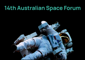
The Andy Thomas Space Foundation is looking forward to welcoming a global audience to the 14th Australian Space Forum, which will be held on Tuesday, 25 October 2022 at the Adelaide Convention Centre in South Australia.
Supported by the Australian Space Agency, the South Australian Space Industry Centre and SmartSat CRC, the Forum will provide an opportunity to stimulate ideas, share information about emerging technologies and network with influential space sector leaders and the broader community.
Participants can attend in-person, or virtually through the event’s global interactive platform.
Forum sessions will include international panels covering highly pertinent topics that shape our industry:
Earth Observation: The National Space Mission for Earth Observation is a major investment that will expand Australia’s capability in designing, manufacturing and operating space- and ground-based systems.
Optical Communications: A quantum leap in Australia’s secure and high-bandwidth communications to connect the world and beyond.
Foundation Services Rover: Exploring remote operations and autonomous systems by building on Australian expertise in the resources and mining sectors for the collection of lunar soil (regolith).
Each year, the Locate conference attracts hundreds of national and international delegates from within and outside the spatial and surveying industry.
As Australia’s premier spatial and surveying conference, Locate provides guests with a unique opportunity to learn about the latest trends and applications in geospatial technologies.
Are you passionate about our industry and want to get involved? Maybe you have an idea for a local tour, or a project site visit or even have another event that can run in conjunction with Locate. This is your opportunity to help shape the 2023 event — no idea is too big or too small. Reach out to the organisers via info@locateconference.com or +61 2 4319 8519.
SmartSat partners, participants, students and staff are invited to come together to share their research outcomes and network with industry colleagues at the SmartSat CRC Conference 2023.
The SmartSat CRC is a consortium of universities and other research organisations, partnered with industry that has been funded by the Australian Government to develop know-how and technologies in advanced telecommunications and IoT connectivity, intelligent satellite systems and Earth observation next generation data services.
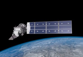
Landsat image courtesy NASA/GSFC

Hosted by the Riverina Eastern Regional Organisation of Councils and the Riverina Spatial Information Group, Mapped Out 2023 will bring together public- and private-sector professionals to learn about the latest geospatial developments.
Mapped Out will highlight the diversity of applications for spatial data, geographic information systems and their supporting technologies. Guest speakers with local and national experience will be showcasing the use of spatial data to enhance the operation and delivery of government services.
The Conference is a great opportunity for people working in regional NSW in both local government and the private sector to keep abreast of the latest technology and geographical information systems that can be utilised in their day-to-day work.

The 2024 edition of the International Conference on Geographical Information Systems Theory, Applications and Management (GISTAM 2024) aims to create a meeting point of researchers and practitioners that address new challenges in geo-spatial data sensing, observation, representation, processing, visualization, sharing and managing, in all aspects concerning both ICT as well as management information systems and knowledge-based systems.
The conference welcomes original papers of either practical or theoretical nature, presenting research or applications, of specialised or interdisciplinary nature, addressing any aspect of geographic information systems and technologies, such as:
- Data acquisition and processing
- Remote sensing
- Interaction with spatial-temporal information
- Spatial data mining
- Managing spatial data
- Modelling, representation and visualisation
- GIS and climate change
- Domain applications


