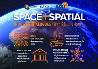
During 2020 an expert group drafted the SPACE+SPATIAL Industry Growth Roadmap 2030 – a national snapshot for Australian professionals to better understand the bold new future that’s rapidly approaching and what it means for them, their careers, their organisations and all of Australia.
The National Steering Committee is seeking feedback on the Roadmap from spatial professionals of all levels across the country. There are a number of ways to get involved, one of which is to participate in this SSSI and SIBA|GITA SPACE+SPATIAL Roadmap Online Session.
You will hear about the key plans, activities and issues and have the opportunity to have a meaningful discussion with colleagues about your thoughts on the Roadmap Consultation Paper and the topic in general.

The presenters for this topical webinar will be Dr Craig Roberts, Senior Lecturer in Surveying/GPS/Geodesy at UNSW and Wayne Patterson Director, Spatial Operations at the NSW Department of Customer Service.
Roberts will give a short update on the revision of the Australian Standard, AS_5488 Classification of subsurface utility information in the context of datum modernisation, low-cost multi-GNSS and recent advances in positioning infrastructure in Australia.
Data storage, data distribution and security are identified as challenges suggesting a reimagined data governance will be needed. Could a spatial digital twin assist? What is a spatial digital twin? Is it a BIM? Where does it come from? What is an open data policy? Who can use it? Can I use it? Which datum? How accurate is the data?
Rather than just another PowerPoint webinar, Roberts will interview Patterson in a free-flowing format. Attendees will be invited to ask their own questions live in the chat as the conversation evolves.
This webinar is targeted at surveyors, geospatial users, students and the wider spatial community.

RPAS in Australia Skies is back for 2023. The conference is the Australian Association for Uncrewed Systems’ (AAUS) main event for the year and has established itself as a landmark event for the Australian drone industry, drawing interest from key government personnel, representatives from the regulatory and safety bodies, defence force, RPAS and UTM representatives, end users and academia.
The hybrid event will take place over two days and will include a combination of presentations and interactive panel discussions.
The conference will cover:
- RPAS related policy and regulatory updates from Australian and international government agencies.
- UAS Traffic Management, low-level airspace and integrated airspace systems
- Industry challenges and perspectives
- Continuing development of a professional and safe industry.
- Emerging technologies and innovative solutions enabling RPAS integration in Australian airspace.
- Emerging applications — benefits, viability and social acceptance
- Case studies of drone use and challenges in emergency services, infrastructure inspection, delivery, mining, and agriculture.

The Remote Hydrography conference and exhibition brings together manufacturers, operators, regulators, and research and development leaders from both industry and academia, within the field of remote surveying and uncrewed survey operations.
Remote Hydrography 2024 provides an opportunity to share experience gained in the development and application of autonomous and uncrewed platforms (surface, underwater, aerial and space-based) and the associated command and support services.
These and enabling technologies like machine learning and artificial intelligence will revolutionise workflows for hydrographic data collection, processing, analysis and presentation.

Registrations are now open for the Geospatial Council of Australia’s 2024 International Women’s Day breakfast in Brisbane on 8 March. The breakfast will bring together women from across the geospatial sector to share experiences and foster connections among the remarkable individuals shaping the future of geospatial technology.
The event will also serve as a platform to amplify the voices of women in this field, highlighting their contributions, innovation and leadership.
Whether you’re a seasoned professional, an aspiring newcomer or a passionate advocate, these events promise to be filled with inspiring discussions, networking opportunities and empowering insights.
The details are:
- GCA members: $75 (incl. GST)
- Non-GCA members: $100 (incl. GST)
- Student members: $50 (incl. GST)
- Tables can seat up to 8.
- Time: 7:30am to 9:30am
- Venue: Rydges South Bank (Rooftop South), 9 Glenelg St, South Brisbane
- Register
Registrations close Thursday, 29 February.
The breakfast is sponsored by 1Spatial, with other sponsorship opportunities still available. Contact events@geospatialcouncil.org.au for further information.


