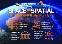
During 2020 an expert group drafted the SPACE+SPATIAL Industry Growth Roadmap 2030 – a national snapshot for Australian professionals to better understand the bold new future that’s rapidly approaching and what it means for them, their careers, their organisations and all of Australia.
The National Steering Committee is seeking feedback on the Roadmap from spatial professionals of all levels across the country. There are a number of ways to get involved, one of which is to participate in this SSSI and SIBA|GITA SPACE+SPATIAL Roadmap Online Session.
You will hear about the key plans, activities and issues and have the opportunity to have a meaningful discussion with colleagues about your thoughts on the Roadmap Consultation Paper and the topic in general.

Registrations are now open for the Australian Institute of Mine Surveyors (AIMS) Kalgoorlie Regional Seminar, which will be held at the Kalgoorlie Bowling Club on Friday, 29 October.
The day will start at 2:30pm with an optional lawn bowls and beers social occasion, followed at 4:00pm by AIMS sessions and a sponsor interaction session. Drinks and nibbles will be supplied. Sponsors include AAM, Arvista, Caroni, Deswik, GeoCue Australia, HL Geospatial and Maptek.
There are various levels of registration fees depending upon member category. Full details can be found at the link above.

The WA geospatial community will come together on 16 February 2022 to learn, network, share experiences and catch up with colleagues old and new.
The WA Asia-Pacific Spatial Excellence Awards dinner will also be held in conjunction with the conference, celebrating the outstanding work being undertaken across the region during 2022.
Image credit: ©stock.adobe.com/au/anekoho

The 2023 Queensland Geospatial Conference & Awards Dinner will be held in Brisbane on Friday, 20 October 2023.
The conference will be a chance for the Queensland geospatial community to learn about the latest projects and research, connect with colleagues and see the latest technology from local suppliers. The conference will be followed by the awards dinner.
Presentation abstract proposals are being accepted until Monday, 28 August.
Image credit: ©stock.adobe.com/au/rudi1976

The 4th International Symposium on Applied Geoinformatics (ISAG2024), which will take place at the Wroclaw University of Science and Technology, Wroclaw, Poland, on 9 and 10 May 2024. ISAG2024 is jointly organised by the Department of Geomatics Engineering, Yildiz Technical University, Istanbul, Türkiye, Wroclaw University of Science and Technology, Wroclaw, Poland and Technical University of Crete, Chania, Crete, Greece.
The aim of the 4th ISAG is to bring scientists, engineers and industry researchers together to exchange and share their experiences and research results and discuss the practical challenges encountered and the solutions adopted in geoinformatics.
Topics to be covered include recent advances in AI, satellite imagery, advanced remote sensing, photogrammetry, image processing, global navigation satellite systems, height systems, terrestrial laser scanning, GIS, smart cities and land management.


