Eugene Lamnek created GeoIT Solutions in 2002, and has been developing ArcGIS customizations, add-ins and applications ever since. In this time Eugene has developed numerous bushfire applications for the CFS and the CFA as well as water and wastewater modelling software, asset management applications and interfaces, and open source applications for numerous clients including SA Water, Santos and DEW.
The Treatment Reporting System (TRS) currently in pilot phase, will allow organisations to store and manage their bushfire mitigation tasks, as well as measuring these tasks against the requirements of the Bushfire Management Area Plans (BMAPs). The system will allow users to store bushfire mitigation tasks, their spatial extent, values of work, time of work and completion status. Tasks are mapped and measured against required actions, defined by within the CFS BMAPs. The TRS will provide an effective mechanism for reporting the adequacy of on ground mitigation work (potentially at a State-wide level) by measuring mitigation work against well-defined mitigation targets. Users of the system will include local government, state government, private organisations and potentially even individual landholders.
Venue
Zoom Webinars
Cost
SSSI Members $30 | Non-Members $45 | SSSI YPs $20 | SSSI Student Members FREE
Contact
SSSI South Australia | rom.sa@sssi.org.au | 08 8212 0359

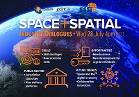
During 2020 an expert group drafted the SPACE+SPATIAL Industry Growth Roadmap 2030 – a national snapshot for Australian professionals to better understand the bold new future that’s rapidly approaching and what it means for them, their careers, their organisations and all of Australia.
The National Steering Committee is seeking feedback on the Roadmap from spatial professionals of all levels across the country. There are a number of ways to get involved, one of which is to participate in this SSSI and SIBA|GITA SPACE+SPATIAL Roadmap Online Session.
You will hear about the key plans, activities and issues and have the opportunity to have a meaningful discussion with colleagues about your thoughts on the Roadmap Consultation Paper and the topic in general.

RPAS in Australia Skies is back for 2023. The conference is the Australian Association for Uncrewed Systems’ (AAUS) main event for the year and has established itself as a landmark event for the Australian drone industry, drawing interest from key government personnel, representatives from the regulatory and safety bodies, defence force, RPAS and UTM representatives, end users and academia.
The hybrid event will take place over two days and will include a combination of presentations and interactive panel discussions.
The conference will cover:
- RPAS related policy and regulatory updates from Australian and international government agencies.
- UAS Traffic Management, low-level airspace and integrated airspace systems
- Industry challenges and perspectives
- Continuing development of a professional and safe industry.
- Emerging technologies and innovative solutions enabling RPAS integration in Australian airspace.
- Emerging applications — benefits, viability and social acceptance
- Case studies of drone use and challenges in emergency services, infrastructure inspection, delivery, mining, and agriculture.

The 2023 ACT Geospatial Conference and Excellence Awards will bring together colleagues old and new to hear the latest updates from across the local geospatial industry.
The call for abstracts for the event is now open. Any topic of interest to the geospatial industry is welcome, including surveying (cadastral, engineering, hydrographic, mining), GIS, remote sensing and geodesy, or broader topics such as new technology, diversity and workforce management.
The deadline for submission of abstract proposals closes at midday on Tuesday, 3 October.
The Geospatial Excellence Awards Reception will be held at the conclusion of the conference sessions, giving attendees the chance to enjoy drinks and canapes whilst networking and celebrating the award winners.
Image credit: ©stock.adobe.com/au/r-o-x-o-r


