At 1Spatial we use validation, integration, automation and our rules-based approach to build strong data infrastructures, leading to better outcomes and making your data smarter.
Have you thought about how you will transform your data to GDA2020?
During this session, we will help you understand the requirements needed for GDA2020 and the best way to migrate your data to this new datum!
Join our team for a free webinar on Friday 27th November and hear how we can help you migrate your data to GDA2020.
Agenda
- Recognising your data and understanding the effect this will have on your data
- Authoritative data sets that already exist
- GA & ICSM slides defining the height datum + case studies of support issues
- Transformations with FME
- Ensuring your organisation has a plan for the transformation
- How we can help you implement the move
In the meantime, if you have any technical questions, or you’d just like a quotation on one of our products, some training or a dedicated consultancy session from one of our specialised consultants, just send us some details to sales.australia@1spatial.com and we’ll be sure to get back to you.
Whether you’re new to FME or an experienced user, our free webinars are packed with tips, tricks and knowledge to take your FME expertise to the next level!

FME 2021 has landed and there’s a lot to take in, so much so, that what might seem like an insignificant new feature at first can have some serious benefits to your data integration routines.
In this session, we’ll hear from our 5 highly qualified consultants on what their 5 hot features are in FME and why you might want to take a closer look.
Agenda
- Enterprise Integration – Using the connectors Safe continues to introduce each year to better integrate FME Server with other systems.
- The FME Parameter Manager – How to improve the user experience of FME parameters in 2021 with the FME Parameter Manager.
- Self Service –Are you tired of doing repetitive tasks? We’ll cover off how you can use FME technology to provide self-service functions to people within your organisation. Self-service data access, data submissions and requests can be streamlined using FME.
- Creating PDF Reports – Do you need to create PDF reports as part of your ETL process? These tips can help you create pretty PDF reports via FME.
- Getting Started Quickly with FME Cloud – Access the power of FME Server instantly without the burden of managing hardware and security.
This webinar is part of our free FME education programme where we focus on one specific topic and dive deep under the covers to highlight a particular data challenge or solution. All of our historic webinars are published on our on-demand webinar page, just in case you missed a session, you can review it there… but if you join us on the live session you’ll have the opportunity to ask our expert presenter some questions around the topic.
In the meantime, if you have any technical questions, or you’d just like a quotation for FME, some training or a dedicated consultancy session from one of our FME Certified Professionals, just send us some details to Sales.australia@1spatial.com and we’ll be sure to get back to you.

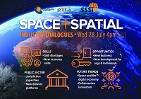
During 2020 an expert group drafted the SPACE+SPATIAL Industry Growth Roadmap 2030 – a national snapshot for Australian professionals to better understand the bold new future that’s rapidly approaching and what it means for them, their careers, their organisations and all of Australia.
The National Steering Committee is seeking feedback on the Roadmap from spatial professionals of all levels across the country. There are a number of ways to get involved, one of which is to participate in this SSSI and SIBA|GITA SPACE+SPATIAL Roadmap Online Session.
You will hear about the key plans, activities and issues and have the opportunity to have a meaningful discussion with colleagues about your thoughts on the Roadmap Consultation Paper and the topic in general.

The Survey and Spatial New Zealand 2021 Annual Conference will draw on the ability of individuals and teams to adapt to change, adversity and setbacks in the current environment.
The conference program will include presentations on rebuilding and improving the economy, with a focus on resilient mindsets to support our members while they navigate the challenges and changes ahead. By sharing concepts, ideas and knowledge, industry members have opportunities to help build back the survey and spatial sector.

The 10th Land Administration Domain Model Workshop (LADM 2022) will be held in Dubrovnik, Croatia from 31 March to 2 April 2022. This is an on-site event at Hotel Dubrovnik Palace, with possibilities for remote participation. The workshop is being organised in conjunction with 7th Croatian Congress on Cadastre.
Image credit: ©stock.adobe.com/au/incomible
Put your pedal to the FMEdal and join us for the FME World Tour 2022!

Is your data driving you crazy? Overtake the competition with FME 2022! Register now to join us in a city near you. Whether you’re a newbie, just discovering the power of FME or an expert and hungry for new functionality, these fun events should be in your calendar!
Take a look at some of the most popular reasons to attend a World Tour event near you:
- Hear customer success stories and gain valuable insight on data integration strategies
- Get up to speed with FME 2022 new capabilities
- Our FME Pit Crew “Certified professionals” will be on the ground to answer any questions you may have.
- Plus lots of great prizes to be won!

Survey and Spatial NZ’s 2022 conference will be held from 1 to 3 August at the Novotel Lakeside, Rotorua. The conference is the biggest continuing professional development event of the year for NZ surveying and spatial professionals. It invites sharing of knowledge amongst peers, bringing together networking opportunities for all delegates and is an essential event for professional development and connectivity within the sector.
The choice of Rotorua as the location is apt, given the conference theme of ‘Turning up the Heat’. The organisers aim to stimulate discussion regarding challenges in regional areas, which include climate change and developments outside of Auckland.

The Local Government Spatial Reference Group (LGSRG) will be holding a webinar on Monday, 4 September, to introduce a series of hands-on workshops it will be holding across Victoria during September 2023.
The webinar will cover the topic of Best Practice Geospatial Intelligence for Climate Impact, and will address important topics on climate impact, community safety and how geospatial intelligence can contribute to better outcomes for local governments.
The LGSRG was formed in 2003 to address the need for a sector wide group representing the strategic interests of the Victorian Local Government sector with respect to spatial information. The LGSRG has been active throughout the COVID pandemic to keep the local government geospatial community connected and engaged via the annual Spatial Capability Workshop series which have grown year on year, and is now diversifying with a quarterly Spatial Hour webinar to share stories of success within the local government geospatial sector.
Image credit: ©stock.adobe.com/au/yutthana

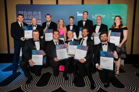
Each year representatives from the Association of Consulting Surveyors NSW and the Institution of Surveyors NSW come together to organise the NSW Excellence in Surveying and Spatial Information (EISSI) Awards.
The awards recognise the achievements of organisations and individuals from across the state who are engaged in the surveying and spatial information profession; celebrate excellence before an audience of industry peers; encourage activities that create a stronger, larger and more relevant industry; and embrace the achievements of the industry and its related industries and professions.

The 3rd International Land Management Conference, hosted by the University of the West of England, will be held online on 14 and 15 March 2024. The event will bring together experts and professionals in land management to discuss inclusive land tenure, efficient land markets, sector reform and innovations in land research.
The conference will focus on four themes:
- Theme 1: Can we build more inclusive and resilient land tenure systems by understanding social value and climate change?
- Theme 2: How can land administration systems contribute to efficient and equitable land markets?
- Theme 3: What approaches can Development Partners use to help achieve more successful Land Administration sector reform?
- Theme 4: LINK – Early Career Professionals and Junior Researchers – Innovations in Land Research and Practice
The conference is organised by LINK, the Land–International Network for Knowledge — a network of academic organisations, professional practice and development partners, as well as public and private sector country partners — in association with the University of the West of England.


