We are happy to announce the SAVE THE DATE for the 2019 National Conference!
Building on the success of the 2018 National Conference we are anticipating a good attendance again this year.
The Conference will be held at the Sheraton Grand Sydney Hyde Park which has recently had a $50 million refurbishment.
Call for papers will be announced shortly and more information will follow in the coming weeks.
If you have any questions please feel free to contact the Conference Manager Dean Kerr on email dean@cimages.com.au or via mobile 0422 632 608.

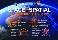
During 2020 an expert group drafted the SPACE+SPATIAL Industry Growth Roadmap 2030 – a national snapshot for Australian professionals to better understand the bold new future that’s rapidly approaching and what it means for them, their careers, their organisations and all of Australia.
The National Steering Committee is seeking feedback on the Roadmap from spatial professionals of all levels across the country. There are a number of ways to get involved, one of which is to participate in this SSSI and SIBA|GITA SPACE+SPATIAL Roadmap Online Session.
You will hear about the key plans, activities and issues and have the opportunity to have a meaningful discussion with colleagues about your thoughts on the Roadmap Consultation Paper and the topic in general.

The Survey and Spatial New Zealand 2021 Annual Conference will draw on the ability of individuals and teams to adapt to change, adversity and setbacks in the current environment.
The conference program will include presentations on rebuilding and improving the economy, with a focus on resilient mindsets to support our members while they navigate the challenges and changes ahead. By sharing concepts, ideas and knowledge, industry members have opportunities to help build back the survey and spatial sector.

Hosted by 12d – the companies behind 12d Model and 12d Synergy – the highly anticipated 12d Tech Forum returns on 19 – 21 October 2021. The three-day online industry summit will connect over 2,000 surveying, engineering, and construction professionals to learn, innovate, and be inspired.
The 12d Tech Forum provides surveying and geospatial professionals with an excellent training opportunity to keep up to date with the latest innovations and advancements in the industry.
50+ Hours of Inspiring Industry Talks
The 12d Tech Forum will host over 50 hours of industry insights, case studies from cutting-edge Australian and New Zealand surveying projects, and actionable training content. Delivered by some of the greatest minds and speakers in the industry. Talks are tailored for surveyors, engineers, and directors, not just 12d operators.
Free Access to All Keynote Presentations
We’ve secured a huge line-up of 40+ industry speakers, including talks from Land Surveys, Fulton Hogan, GHD, SMEC, Piritahi, and many more.
A few keynote titles include:
- Pilbara Desert Collaboration: Land Surveys’ data management strategy collaborating across the Pilbara desert
- GDA2020 at Mackay City Council: Practical insights into successfully implementing GDA2020 through 12d Model
- Piritahi Case Study: 10,000 lot land development project to crush the Auckland housing crisis
- TfNSW Steering Group & Uniform Coding: Aligning managed utilities through a consistent framework for delivery
Best yet, all sessions will be recorded and available to watch on-demand for 12 months after the event.
Surveying and Geospatial Topics Include…
- BIM & Digital Engineering
- Land & Construction Surveying
- GDA2020, ADAC, A-SPEC
- Point Clouds
- Drone Surveying & Photogrammetry
- Mobile Mapping & GIS
- Digital Twins & Asset Management
- Data Management & Collaboration
Check Out the Preliminary Event Agenda
To see a comprehensive list of keynotes and topics that will be covered at the 12d Tech Forum 2021, check out our Preliminary Event Agenda here.
12d Training Breakout Streams
For more tailored training content focused on upskilling your use of 12d software, purchase a Training Pass (A$149 +GST). Here you will have access to an additional five technical streams covering topics on Design, Survey, Water, Data Management, and Training.
Accrue CPD Points
Every hour you watch of the 12d Tech Forum can earn you 1 CPD point for many industry institutions, such as SSI, Australian Consulting Surveyors, Engineers Australia, and many more.
Virtual Networking Sessions
Meet like-minded individuals and build lasting relationships with our virtual networking sessions. The online forum will be attended by thousands of surveying, mapping, and geospatial professionals from across Australia, New Zealand, and abroad.
Register for FREE Today
Join over 2,000 professionals and gain access to 50+ hours with 150+ in-depth talks, delivered by over 60 speakers. Register for your free Industry Pass today!
To learn more and register, visit 12dtechforum.com/

Survey and Spatial NZ’s 2022 conference will be held from 1 to 3 August at the Novotel Lakeside, Rotorua. The conference is the biggest continuing professional development event of the year for NZ surveying and spatial professionals. It invites sharing of knowledge amongst peers, bringing together networking opportunities for all delegates and is an essential event for professional development and connectivity within the sector.
The choice of Rotorua as the location is apt, given the conference theme of ‘Turning up the Heat’. The organisers aim to stimulate discussion regarding challenges in regional areas, which include climate change and developments outside of Auckland.

The Local Government Spatial Reference Group (LGSRG) will be holding a webinar on Monday, 4 September, to introduce a series of hands-on workshops it will be holding across Victoria during September 2023.
The webinar will cover the topic of Best Practice Geospatial Intelligence for Climate Impact, and will address important topics on climate impact, community safety and how geospatial intelligence can contribute to better outcomes for local governments.
The LGSRG was formed in 2003 to address the need for a sector wide group representing the strategic interests of the Victorian Local Government sector with respect to spatial information. The LGSRG has been active throughout the COVID pandemic to keep the local government geospatial community connected and engaged via the annual Spatial Capability Workshop series which have grown year on year, and is now diversifying with a quarterly Spatial Hour webinar to share stories of success within the local government geospatial sector.
Image credit: ©stock.adobe.com/au/yutthana

The Australian Institute of Mine Surveyors (AIMS) National Conference 2023 will be held at the Hyatt Regency Sydney from 13 to 15 September 2023. This is the premier event on the AIMS calendar and should not be missed, especially with more than 20 sponsors in attendance showcasing the latest equipment and technology.
The conference’s keynote speaker will be Peter Baines, OAM, one of Australia’s most effective ‘socialprenuers’. A former police officer, he is the founder of the well-known charity ‘Hands Across the Water,’ and as such has created opportunities for hundreds of children in Thailand.
Peter’s humanitarian efforts have been recognised with significant national and international awards. In January 2014, he was awarded the Order of Australia Medal for his International Humanitarian work. In 2016, he received the Most Admirable Order of Direkgunabhorn awarded by the King of Thailand for his devotional services to the Kingdom of Thailand.
A powerful keynote speaker, Peter’s presentations take his audience from laughter to tears as he recounts his story and delivers the lessons he has learned by managing some of the world’s most devastating crises. His tales of the way in which he has contributed to the lives of many less fortunate people in the world, and the realisation of his personal dream are absolutely inspiring.

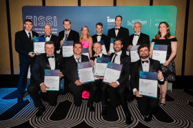
Each year representatives from the Association of Consulting Surveyors NSW and the Institution of Surveyors NSW come together to organise the NSW Excellence in Surveying and Spatial Information (EISSI) Awards.
The awards recognise the achievements of organisations and individuals from across the state who are engaged in the surveying and spatial information profession; celebrate excellence before an audience of industry peers; encourage activities that create a stronger, larger and more relevant industry; and embrace the achievements of the industry and its related industries and professions.


